Baltimore at a glance
| County | Baltimore city |
|---|---|
| Population (2024) | 568,271 |
| Change since 2020 | -3.0% |
| Land area | 80.9 sq mi (plus 11.1 sq mi water) |
| Density | 7,024 per sq mi |
| Elevation | 0 ft to 466 ft, median 157 ft |
| Time zone | Eastern (America/New_York) |
| Coordinates (center) | 39.3000, -76.6105 |
What county is Baltimore in?
Baltimore is in Baltimore city. County lines matter for property taxes, courts, elections and some services, so check your exact address with what county am I in if you live near a line.
Baltimore ZIP codes
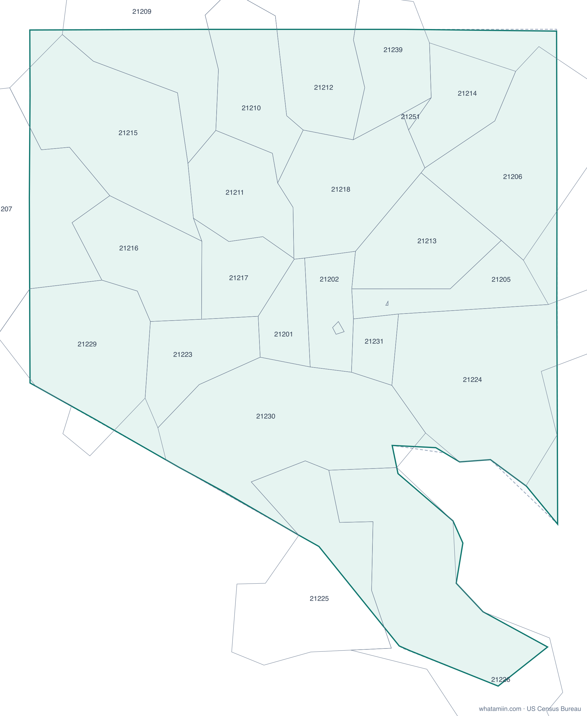
33 ZIP code areas include part of Baltimore. ZIP codes follow mail routes, not city limits, so some Baltimore addresses use a ZIP shared with a neighboring town, and some addresses with a Baltimore mailing address are outside the city.
Mostly inside Baltimore: 21201, 21202, 21205, 21206, 21210, 21211, 21212, 21213, 21214, 21215, 21216, 21217, 21218, 21223, 21224, 21226, 21229, 21230, 21231, 21233, 21239, 21251, 21287
Partly inside: 21207, 21208, 21209, 21222, 21225, 21227, 21228, 21234, 21236, 21237
Elevation of Baltimore
Ground elevation across Baltimore ranges from about 0 ft to 466 ft above sea level, with a median of 157 ft (48 m). These values come from 404 terrain samples spread across the city limits. For the elevation of an exact spot, use what is my elevation.
What time zone is Baltimore in?
Baltimore is in the Eastern Time Zone (America/New_York). Standard time is EST (UTC−5); daylight saving time is EDT (UTC−4), from the second Sunday in March to the first Sunday in November. For the zone at an exact address, use what time zone am I in, or see the Maryland time zone page.
More for Maryland: county map · list of counties · ZIP code map