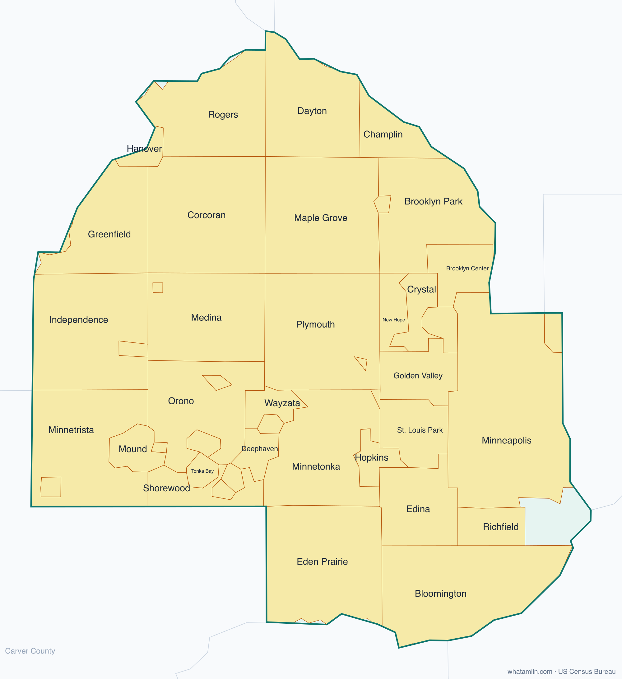
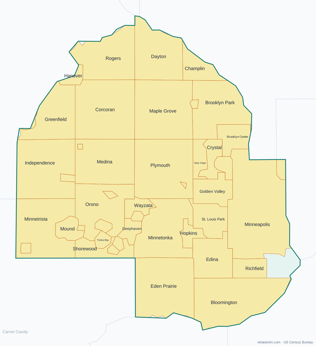
Hennepin County at a glance
| County seat | Minneapolis |
|---|---|
| Population (2024) | 1,273,334 · 1st of 87 in Minnesota |
| Change since 2020 | -0.6% |
| Land area | 554 sq mi |
| Density | 2,298 people per sq mi |
| Time zone | Central |
| Elevation | 702 ft to 1,063 ft (median 915 ft) |
| FIPS code | 27053 |
Cities and towns in Hennepin County
45 incorporated cities, towns and villages have land in Hennepin County, led by Minneapolis with 428,579 residents inside the county. The rest of the county's people live in unincorporated areas, which the county governs directly.
| City or town | Population in county (2024) |
|---|---|
| Minneapolis | 428,579 |
| Bloomington | 88,344 |
| Brooklyn Park | 82,893 |
| Plymouth | 78,551 |
| Maple Grove | 72,739 |
| Eden Prairie | 62,905 |
| Edina | 53,564 |
| Minnetonka | 52,651 |
| St. Louis Park | 49,899 |
| Richfield | 36,491 |
| Brooklyn Center | 31,755 |
| Champlin | 23,045 |
| Crystal | 22,082 |
| Golden Valley | 21,263 |
| New Hope | 20,745 |
| Hopkins | 19,462 |
| Rogers | 14,493 |
| Robbinsdale | 13,993 |
| Dayton | 10,667 |
| Minnetrista | 9,091 |
| Mound | 9,031 |
| Corcoran | 8,378 |
| Orono | 8,228 |
| Shorewood | 7,553 |
| Medina | 7,209 |
| St. Anthony | 6,054 |
| Wayzata | 4,308 |
| Deephaven | 3,762 |
| Independence | 3,710 |
| Greenfield | 2,908 |
| Osseo | 2,526 |
| Excelsior | 2,296 |
| St. Bonifacius | 2,169 |
| Long Lake | 1,937 |
| Maple Plain | 1,648 |
| Spring Park | 1,641 |
| Tonka Bay | 1,540 |
| Medicine Lake | 1,343 |
| Hanover | 763 |
| Greenwood | 713 |
| Loretto | 610 |
| Village of Minnetonka Beach | 537 |
| Rockford | 466 |
| Woodland | 377 |
| Chanhassen | 0 |
Townships and county subdivisions
Bloomington city, Brooklyn Center city, Brooklyn Park city, Champlin city, Chanhassen city, Corcoran city, Crystal city, Dayton city, Deephaven city, Eden Prairie city, Edina city, Excelsior city, Fort Snelling UT, Golden Valley city, Greenfield city, Greenwood city, Hanover city, Hopkins city, Independence city, Long Lake city, Loretto city, Maple Grove city, Maple Plain city, Medicine Lake city, Medina city, Minneapolis city, Minnetonka city, Minnetrista city, Mound city, New Hope city, Orono city, Osseo city, Plymouth city, Richfield city, Robbinsdale city, Rockford city, Rogers city, Shorewood city, Spring Park city, St. Anthony city, St. Bonifacius city, St. Louis Park city, Tonka Bay city, Village of Minnetonka Beach city, Wayzata city, Woodland city
ZIP codes in Hennepin County
73 ZIP code areas include land in Hennepin County. 6 of them lie mostly in a neighboring county.
Mostly in Hennepin County: 55111, 55305, 55311, 55316, 55327, 55331, 55340, 55343, 55344, 55345, 55346, 55347, 55356, 55357, 55359, 55364, 55369, 55373, 55374, 55375, 55384, 55391, 55401, 55402, 55403, 55404, 55405, 55406, 55407, 55408, 55409, 55410, 55411, 55412, 55413, 55414, 55415, 55416, 55417, 55418, 55419, 55420, 55422, 55423, 55424, 55425, 55426, 55427, 55428, 55429, 55430, 55431, 55435, 55436, 55437, 55438, 55439, 55441, 55442, 55443, 55444, 55445, 55446, 55447, 55450, 55454, 55455
Partly in Hennepin County: 55317, 55328, 55341, 55387, 55388, 55421
Neighboring counties
Anoka County · Carver County · Dakota County · Ramsey County · Scott County · Sherburne County · Wright County
See every county on the Minnesota county map or in the list of Minnesota counties, or find ZIP areas on the Minnesota ZIP code map. To check which county an exact address is in, use what county am I in.