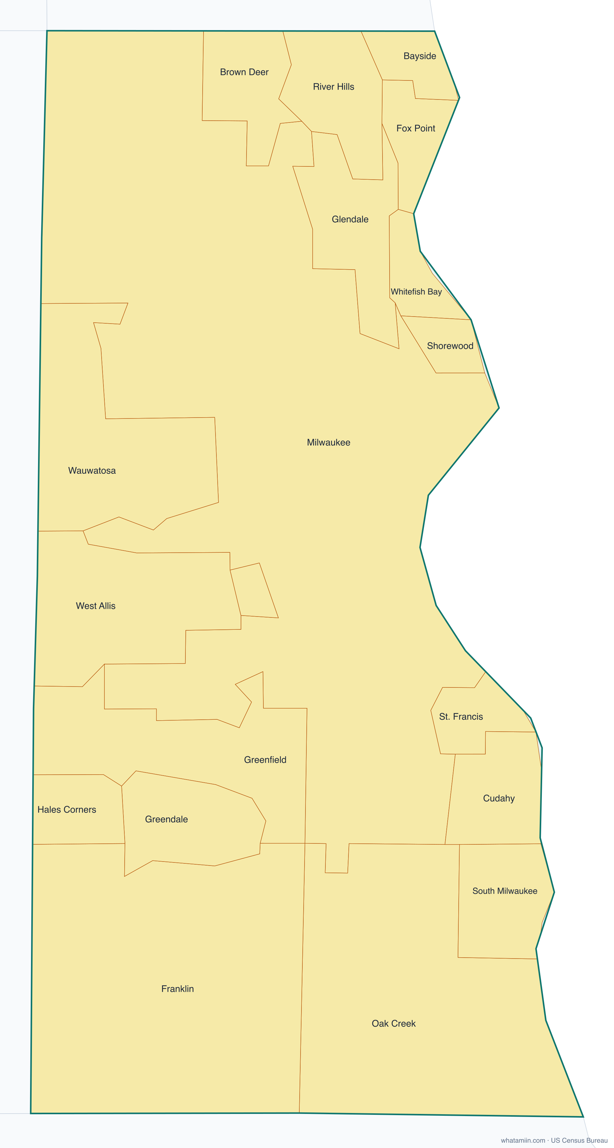
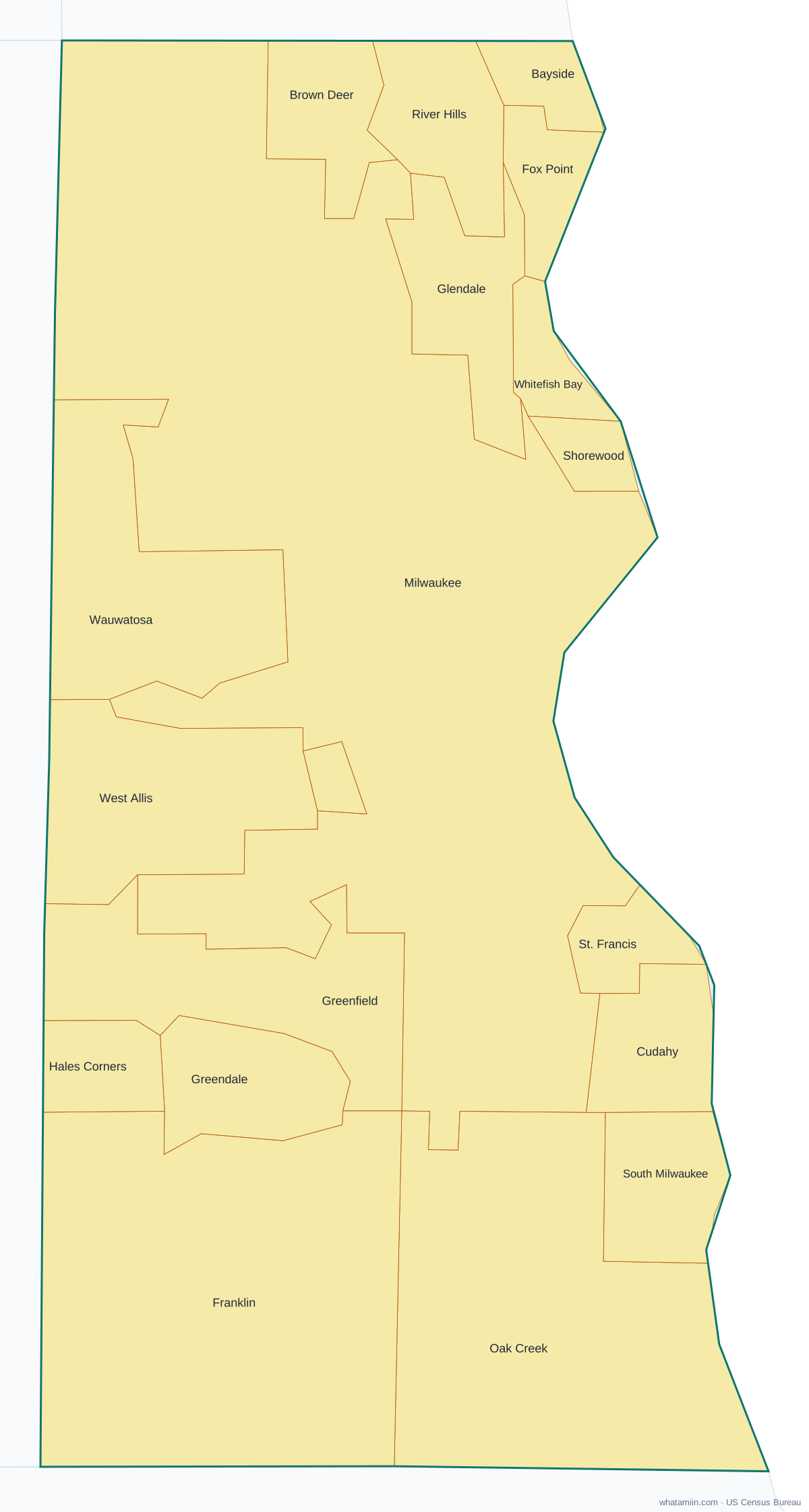
Milwaukee County at a glance
| County seat | Milwaukee |
|---|---|
| Population (2024) | 924,740 · 1st of 72 in Wisconsin |
| Change since 2020 | -1.6% |
| Land area | 242 sq mi |
| Density | 3,829 people per sq mi |
| Time zone | Central |
| Elevation | 584 ft to 850 ft (median 712 ft) |
| FIPS code | 55079 |
Cities and towns in Milwaukee County
19 incorporated cities, towns and villages have land in Milwaukee County, led by Milwaukee with 563,531 residents inside the county. The rest of the county's people live in unincorporated areas, which the county governs directly.
| City or town | Population in county (2024) |
|---|---|
| Milwaukee | 563,531 |
| West Allis | 59,784 |
| Wauwatosa | 48,794 |
| Oak Creek | 38,373 |
| Greenfield | 37,232 |
| Franklin | 36,591 |
| South Milwaukee | 20,233 |
| Cudahy | 17,704 |
| Whitefish Bay | 14,532 |
| Greendale | 14,455 |
| Glendale | 14,381 |
| Shorewood | 13,521 |
| Brown Deer | 12,527 |
| St. Francis | 8,951 |
| Hales Corners | 7,766 |
| Fox Point | 6,591 |
| Bayside | 4,236 |
| West Milwaukee | 3,997 |
| River Hills | 1,541 |
Townships and county subdivisions
Bayside village, Brown Deer village, Cudahy city, Fox Point village, Franklin city, Glendale city, Greendale village, Greenfield city, Hales Corners village, Milwaukee city, Oak Creek city, River Hills village, Shorewood village, South Milwaukee city, St. Francis city, Wauwatosa city, West Allis city, West Milwaukee village, Whitefish Bay village
ZIP codes in Milwaukee County
37 ZIP code areas include land in Milwaukee County. 1 of them lie mostly in a neighboring county.
Mostly in Milwaukee County: 53110, 53129, 53130, 53132, 53154, 53172, 53202, 53203, 53204, 53205, 53206, 53207, 53208, 53209, 53210, 53211, 53212, 53213, 53214, 53215, 53216, 53217, 53218, 53219, 53220, 53221, 53222, 53223, 53224, 53225, 53226, 53227, 53228, 53233, 53235, 53295
Partly in Milwaukee County: 53126
Neighboring counties
Muskegon County, MI · Ottawa County, MI · Ozaukee County · Racine County · Washington County · Waukesha County
See every county on the Wisconsin county map or in the list of Wisconsin counties, or find ZIP areas on the Wisconsin ZIP code map. To check which county an exact address is in, use what county am I in.