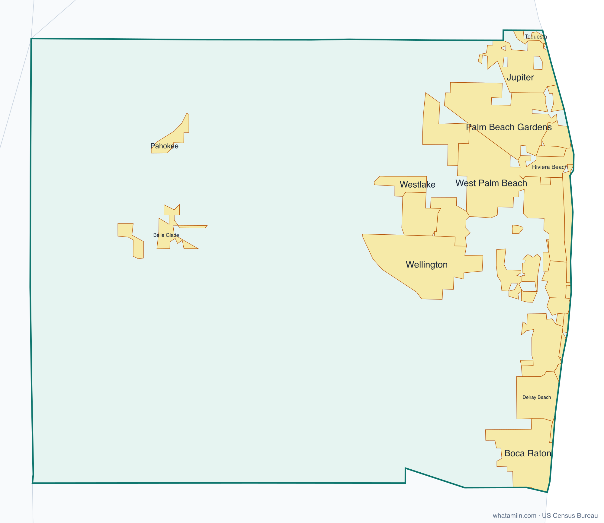
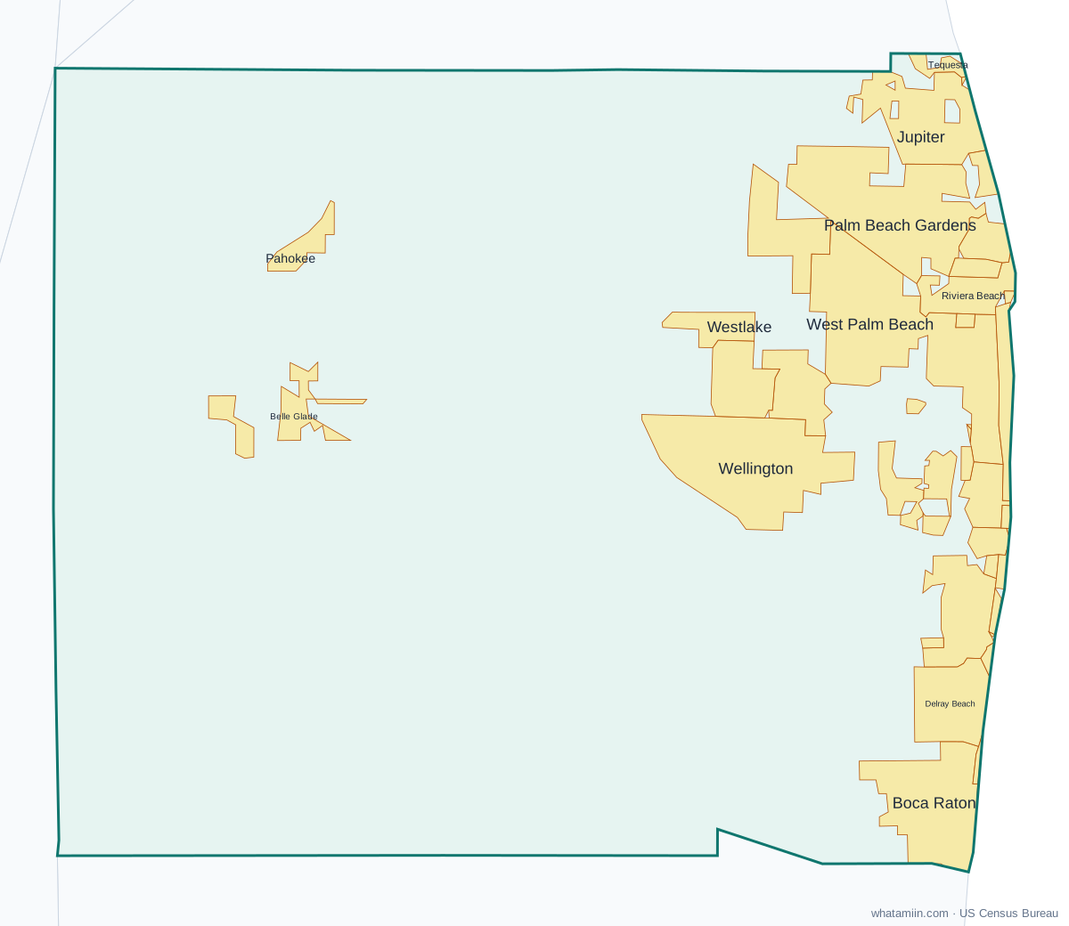
Palm Beach County at a glance
| County seat | West Palm Beach |
|---|---|
| Population (2024) | 1,582,055 · 3rd of 67 in Florida |
| Change since 2020 | +6.0% |
| Land area | 1,964 sq mi |
| Density | 805 people per sq mi |
| Time zone | Eastern |
| Elevation | 3 ft to 69 ft (median 23 ft) |
| FIPS code | 12099 |
Cities and towns in Palm Beach County
39 incorporated cities, towns and villages have land in Palm Beach County, led by West Palm Beach with 127,744 residents inside the county. The rest of the county's people live in unincorporated areas, which the county governs directly.
| City or town | Population in county (2024) |
|---|---|
| West Palm Beach | 127,744 |
| Boca Raton | 102,238 |
| Boynton Beach | 83,095 |
| Delray Beach | 70,140 |
| Palm Beach Gardens | 63,284 |
| Wellington | 63,258 |
| Jupiter | 62,987 |
| Greenacres | 45,197 |
| Lake Worth Beach | 44,417 |
| Royal Palm Beach | 41,948 |
| Riviera Beach | 39,620 |
| Palm Springs | 28,548 |
| Belle Glade | 17,363 |
| North Palm Beach | 13,423 |
| Lantana | 12,545 |
| Palm Beach | 9,493 |
| Lake Park | 9,188 |
| Westlake | 7,664 |
| Tequesta | 6,285 |
| Pahokee | 5,829 |
| South Bay | 5,160 |
| Highland Beach | 4,368 |
| Juno Beach | 3,969 |
| Lake Clarke Shores | 3,629 |
| Loxahatchee Groves | 3,559 |
| Hypoluxo | 2,941 |
| Mangonia Park | 2,643 |
| Haverhill | 2,225 |
| Atlantis | 2,160 |
| Ocean Ridge | 1,888 |
| South Palm Beach | 1,491 |
| Palm Beach Shores | 1,359 |
| Gulf Stream | 994 |
| Briny Breezes | 532 |
| Jupiter Inlet Colony | 456 |
| Manalapan | 441 |
| Golf | 273 |
| Glen Ridge | 218 |
| Cloud Lake | 141 |
Townships and county subdivisions
Belle Glade-Pahokee CCD, Boca Raton CCD, Boynton Beach-Delray Beach CCD, Glades CCD, Jupiter CCD, Lake Worth CCD, Riviera Beach CCD, Royal Palm Beach-West Jupiter CCD, Sunshine Parkway CCD, West Palm Beach CCD, Western Community CCD
ZIP codes in Palm Beach County
53 ZIP code areas include land in Palm Beach County. 3 of them lie mostly in a neighboring county.
Mostly in Palm Beach County: 33401, 33403, 33404, 33405, 33406, 33407, 33408, 33409, 33410, 33411, 33412, 33413, 33414, 33415, 33417, 33418, 33426, 33428, 33430, 33431, 33432, 33433, 33434, 33435, 33436, 33437, 33444, 33445, 33446, 33449, 33458, 33460, 33461, 33462, 33463, 33467, 33470, 33472, 33473, 33476, 33477, 33478, 33480, 33483, 33484, 33486, 33487, 33493, 33496, 33498
Partly in Palm Beach County: 33438, 33440, 33469
Neighboring counties
Broward County · Glades County · Hendry County · Martin County · Okeechobee County
See every county on the Florida county map or in the list of Florida counties, or find ZIP areas on the Florida ZIP code map. To check which county an exact address is in, use what county am I in.
More Florida county profiles: Broward County · Duval County · Hillsborough County · Lee County · Miami-Dade County · Orange County · Pinellas County · Polk County