Jackson County at a glance
| County seat | Kansas City and Independence |
|---|---|
| Population (2024) | 727,362 · 2nd of 115 in Missouri |
| Change since 2020 | +1.4% |
| Land area | 604 sq mi |
| Density | 1,203 people per sq mi |
| Time zone | Central |
| Elevation | 709 ft to 1,083 ft (median 919 ft) |
| FIPS code | 29095 |
Cities and towns in Jackson County
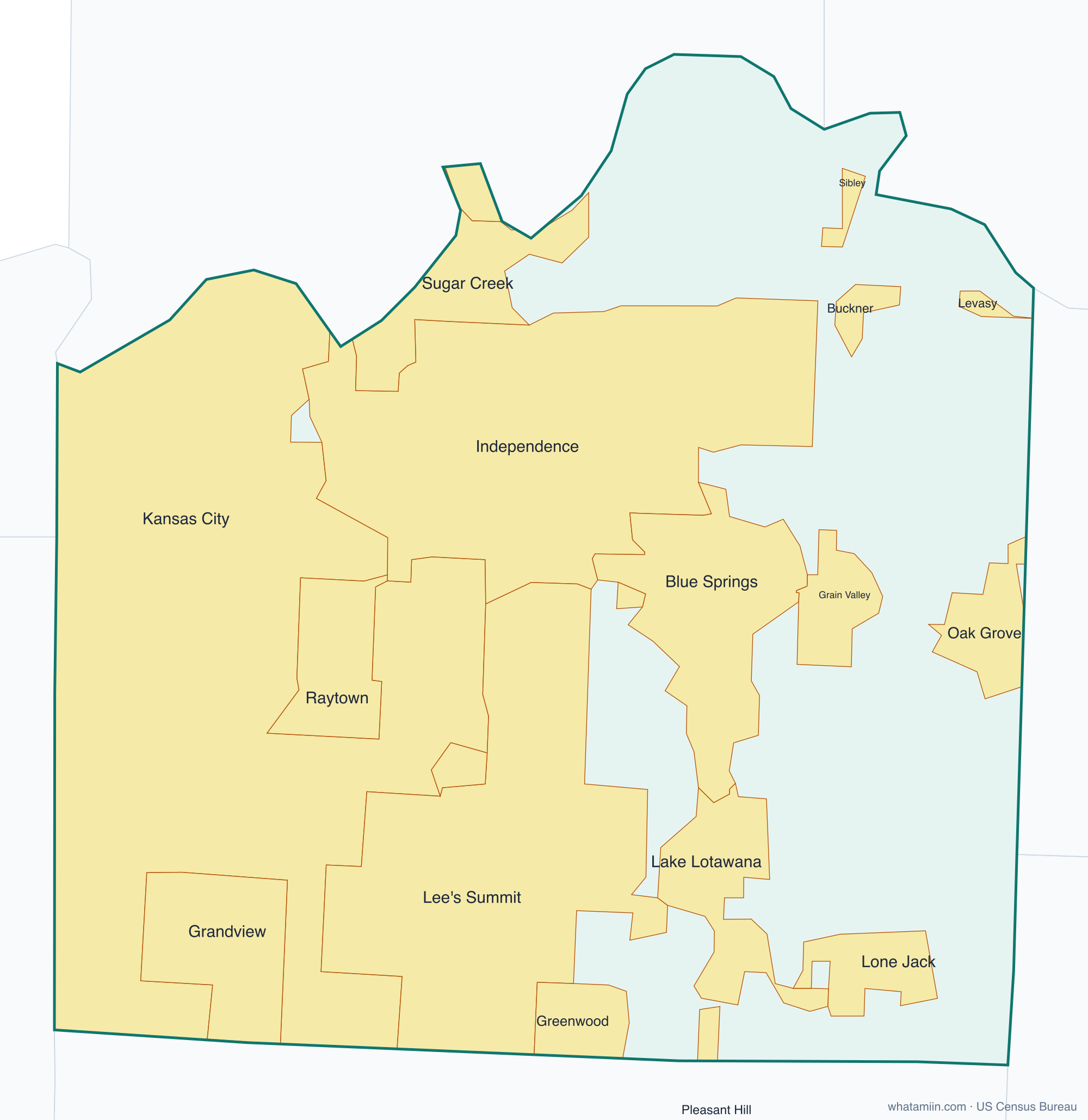
19 incorporated cities, towns and villages have land in Jackson County, led by Kansas City with 317,383 residents inside the county. The rest of the county's people live in unincorporated areas, which the county governs directly.
| City or town | Population in county (2024) |
|---|---|
| Kansas City | 317,383 |
| Independence | 121,629 |
| Lee's Summit | 103,651 |
| Blue Springs | 61,246 |
| Raytown | 29,244 |
| Grandview | 26,630 |
| Grain Valley | 16,859 |
| Oak Grove | 9,013 |
| Greenwood | 5,908 |
| Sugar Creek | 3,223 |
| Buckner | 2,893 |
| Lake Lotawana | 2,648 |
| Lone Jack | 1,820 |
| Lake Tapawingo | 781 |
| Sibley | 320 |
| Levasy | 73 |
| Unity Village | 60 |
| Pleasant Hill | 7 |
| River Bend | 5 |
Townships and county subdivisions
Blue township, Brooking township, Fort Osage township, Kaw township, Prairie township, Sni-A-Bar township, Van Buren township, Washington township
ZIP codes in Jackson County
58 ZIP code areas include land in Jackson County. 2 of them lie mostly in a neighboring county.
Mostly in Jackson County: 64014, 64015, 64016, 64029, 64030, 64034, 64050, 64052, 64053, 64054, 64055, 64056, 64057, 64058, 64063, 64064, 64065, 64066, 64070, 64075, 64081, 64082, 64086, 64088, 64101, 64102, 64105, 64106, 64108, 64109, 64110, 64111, 64112, 64113, 64114, 64120, 64123, 64124, 64125, 64126, 64127, 64128, 64129, 64130, 64131, 64132, 64133, 64134, 64136, 64137, 64138, 64139, 64145, 64146, 64147, 64149
Partly in Jackson County: 64061, 64080
Neighboring counties
Johnson County, KS · Wyandotte County, KS · Cass County · Clay County · Johnson County · Lafayette County · Ray County
See every county on the Missouri county map or in the list of Missouri counties, or find ZIP areas on the Missouri ZIP code map. To check which county an exact address is in, use what county am I in.
More Missouri county profiles: St. Louis County