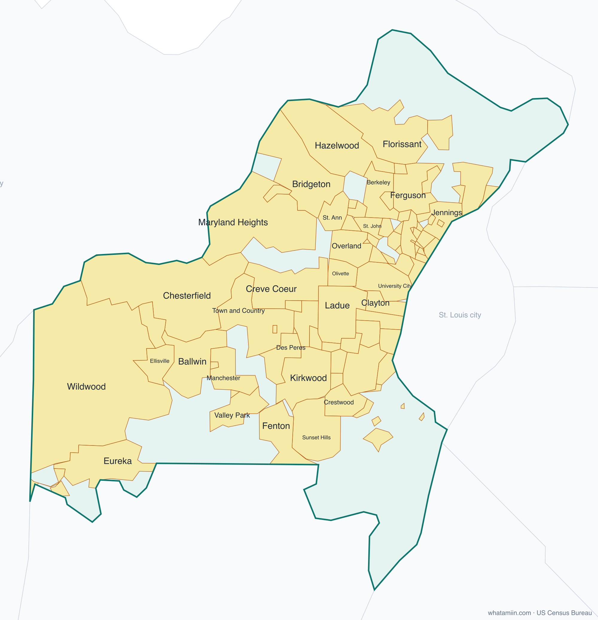
St. Louis County at a glance
| County seat | Clayton |
|---|---|
| Population (2024) | 992,929 · 1st of 115 in Missouri |
| Change since 2020 | -1.2% |
| Land area | 508 sq mi |
| Density | 1,955 people per sq mi |
| Time zone | Central |
| Elevation | 410 ft to 856 ft (median 551 ft) |
| FIPS code | 29189 |
Cities and towns in St. Louis County
88 incorporated cities, towns and villages have land in St. Louis County, led by Florissant with 51,290 residents inside the county. The rest of the county's people live in unincorporated areas, which the county governs directly.
| City or town | Population in county (2024) |
|---|---|
| Florissant | 51,290 |
| Chesterfield | 49,465 |
| Wildwood | 35,082 |
| University City | 34,349 |
| Ballwin | 31,036 |
| Kirkwood | 29,348 |
| Maryland Heights | 27,671 |
| Hazelwood | 24,951 |
| Webster Groves | 23,525 |
| Creve Coeur | 18,533 |
| Manchester | 18,122 |
| Ferguson | 18,043 |
| Clayton | 17,512 |
| Overland | 15,547 |
| Eureka | 13,198 |
| Jennings | 13,024 |
| St. Ann | 12,704 |
| Crestwood | 12,239 |
| Town and Country | 11,625 |
| Bridgeton | 11,301 |
| Bellefontaine Neighbors | 10,401 |
| Ellisville | 10,359 |
| Des Peres | 9,171 |
| Sunset Hills | 9,099 |
| Richmond Heights | 9,096 |
| Olivette | 8,960 |
| Ladue | 8,937 |
| Brentwood | 8,111 |
| Maplewood | 8,077 |
| Berkeley | 8,058 |
| Valley Park | 6,747 |
| Black Jack | 6,575 |
| St. John | 6,472 |
| Shrewsbury | 6,263 |
| Glendale | 6,082 |
| Dellwood | 4,833 |
| Rock Hill | 4,669 |
| Breckenridge Hills | 4,369 |
| Normandy | 4,247 |
| Fenton | 4,073 |
| Woodson Terrace | 3,888 |
| Frontenac | 3,777 |
| Northwoods | 3,592 |
| Pine Lawn | 2,693 |
| Green Park | 2,682 |
| Clarkson Valley | 2,557 |
| Pagedale | 2,516 |
| Riverview | 2,334 |
| Marlborough | 2,191 |
| Moline Acres | 2,102 |
| Bel-Ridge | 2,084 |
| Warson Woods | 1,994 |
| Hanley Hills | 1,964 |
| Vinita Park | 1,934 |
| Wellston | 1,590 |
| Lakeshire | 1,519 |
| Winchester | 1,407 |
| Oakland | 1,378 |
| Bel-Nor | 1,357 |
| Charlack | 1,280 |
Showing the 60 largest of 88.
Townships and county subdivisions
Airport township, Bonhomme township, Chesterfield township, Clayton township, Concord township, Creve Coeur township, Ferguson township, Florissant township, Gravois township, Hadley township, Jefferson township, Lafayette township, Lemay township, Lewis and Clark township, Maryland Heights township, Meramec township, Midland township, Missouri River township, Normandy township, Northwest township, Norwood township, Oakville township, Queeny township, Spanish Lake township, St. Ferdinand township, Tesson Ferry township, University township, Wildhorse township
ZIP codes in St. Louis County
47 ZIP code areas include land in St. Louis County. 4 of them lie mostly in a neighboring county.
Mostly in St. Louis County: 63005, 63011, 63017, 63021, 63025, 63031, 63033, 63034, 63038, 63040, 63042, 63043, 63044, 63045, 63074, 63088, 63105, 63114, 63117, 63119, 63121, 63122, 63123, 63124, 63125, 63126, 63127, 63128, 63129, 63130, 63131, 63132, 63133, 63134, 63135, 63136, 63137, 63138, 63140, 63141, 63143, 63144, 63146
Partly in St. Louis County: 63026, 63049, 63069, 63120
Neighboring counties
Madison County, IL · Monroe County, IL · St. Clair County, IL · Franklin County · Jefferson County · St. Charles County · St. Louis city
See every county on the Missouri county map or in the list of Missouri counties, or find ZIP areas on the Missouri ZIP code map. To check which county an exact address is in, use what county am I in.
More Missouri county profiles: Jackson County