About Montana ZIP code areas
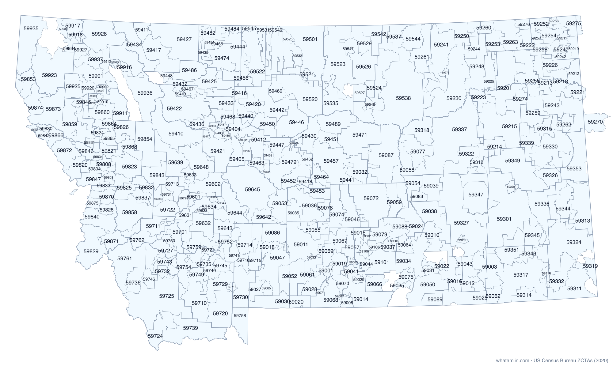
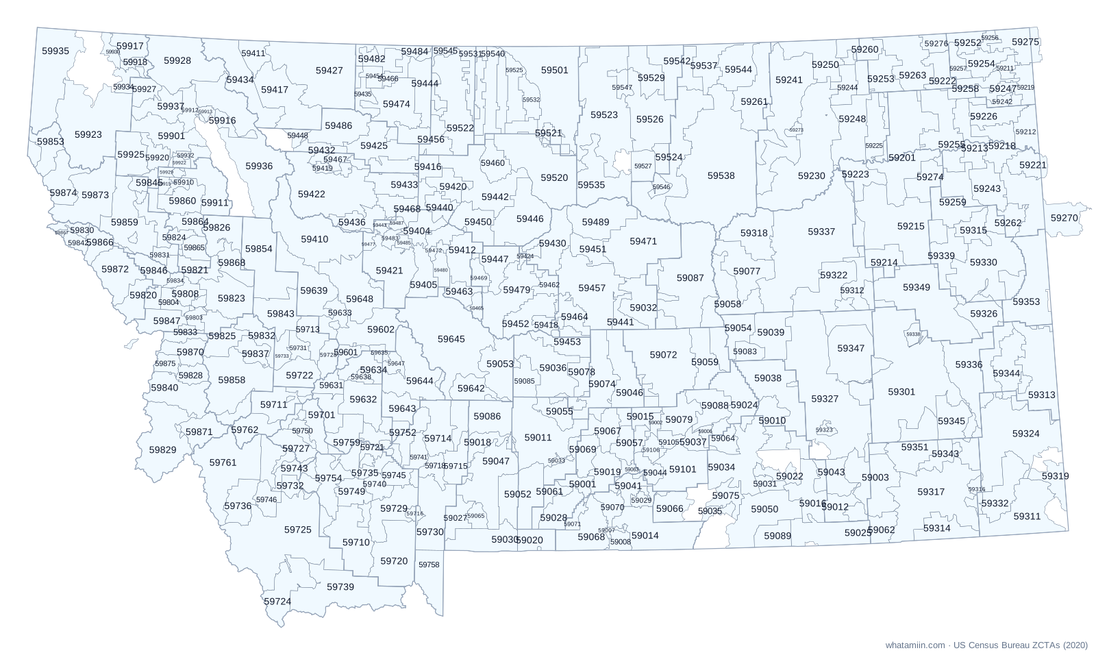
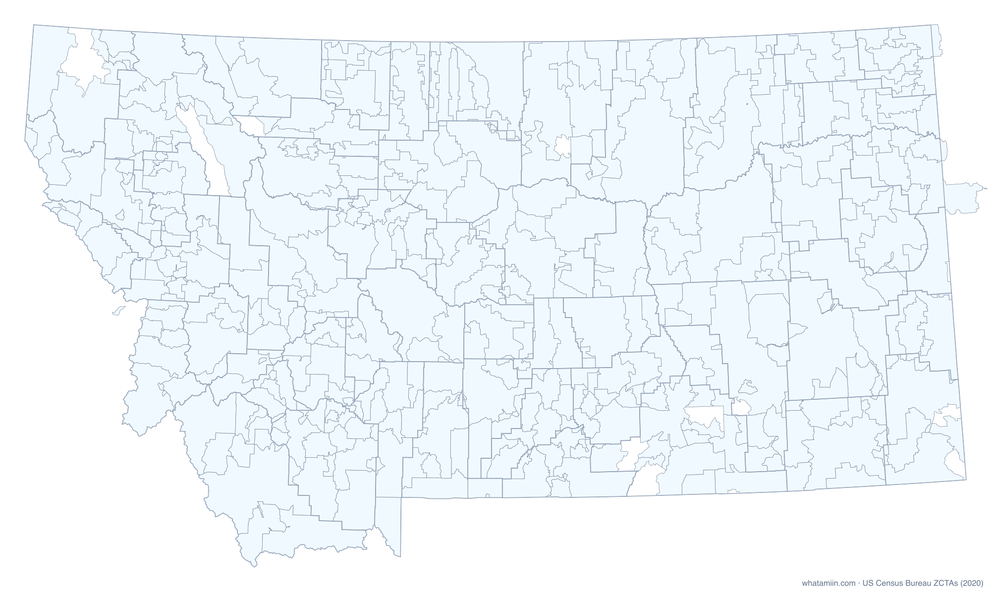
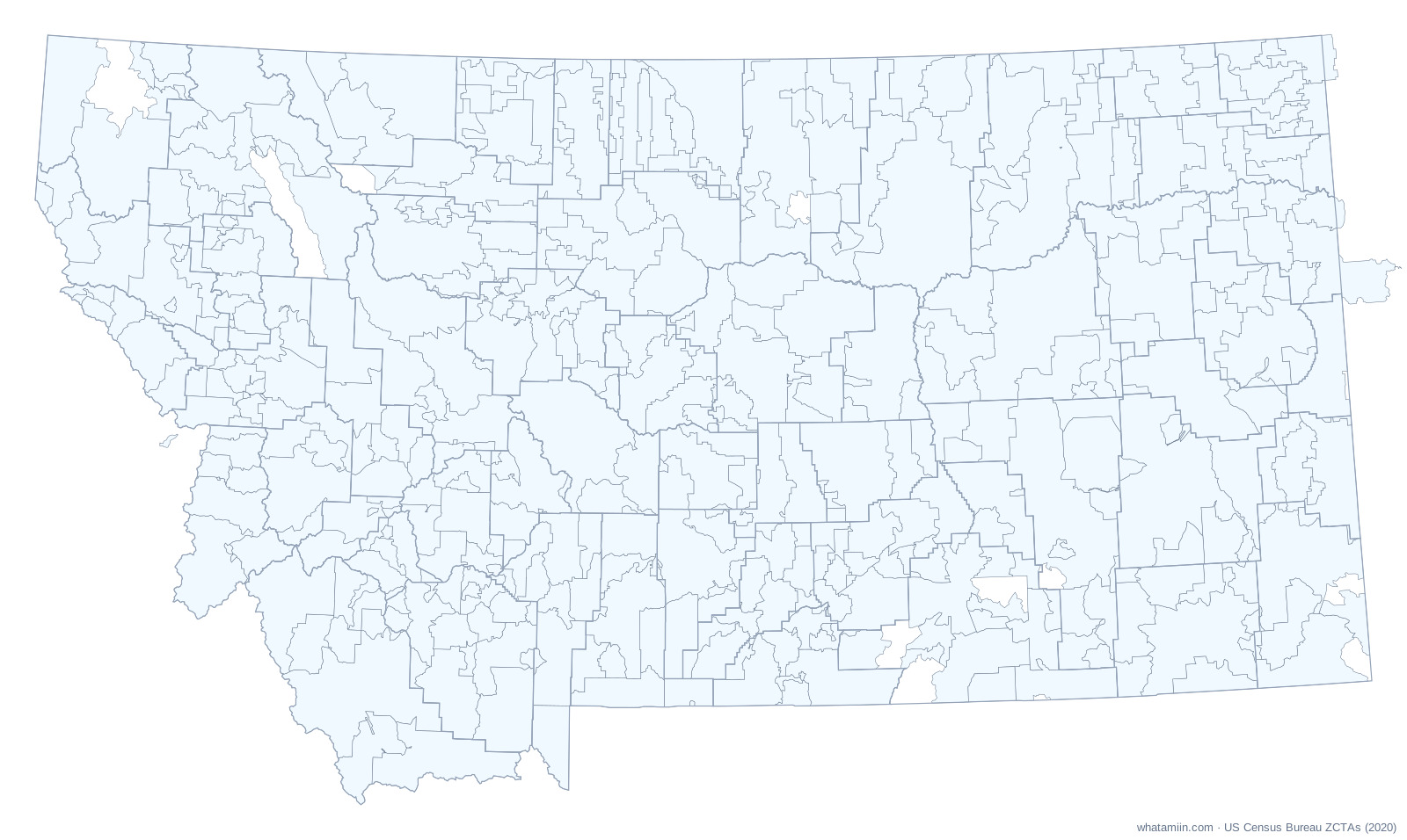
Montana has 369 ZIP code tabulation areas (ZCTAs), the Census Bureau's area version of ZIP codes. Cascade County has the most, with 15. 121 of them cross a county line, which is why a ZIP code alone cannot always tell you the county. The largest by land is 59301 at 2,851.9 square miles.
ZIP codes are mail routes, so the Postal Service has no official boundary map. ZCTAs are built from the ZIP code most common in each census block in 2020. PO-box-only ZIPs and single-building ZIPs have no area and are not on this map. For the exact ZIP area at your location, use what ZIP code am I in.
All Montana ZIP codes
| ZIP | Main city or place | County | Land (sq mi) |
|---|---|---|---|
| 59001 | Absarokee (CDP) | Stillwater, Carbon | 142.8 |
| 59002 | Acton (CDP) | Yellowstone | 79.4 |
| 59003 | Ashland (CDP) | Powder River, Rosebud | 751.1 |
| 59006 | Ballantine (CDP) | Yellowstone | 61.8 |
| 59007 | Bearcreek town | Carbon | 31.7 |
| 59008 | Belfry (CDP) | Carbon | 126.2 |
| 59010 | Unincorporated | Treasure, Big Horn | 360.3 |
| 59011 | Big Timber | Sweet Grass | 936.4 |
| 59012 | Unincorporated | Rosebud | 223.3 |
| 59013 | Boyd (CDP) | Carbon | 4.3 |
| 59014 | Bridger town | Carbon | 759.0 |
| 59015 | Mountain View Colony (CDP) | Yellowstone, Stillwater, Musselshell | 247.8 |
| 59016 | Busby (CDP) | Big Horn | 420.4 |
| 59018 | Clyde Park town | Park | 181.6 |
| 59019 | Columbus town | Stillwater, Carbon | 306.8 |
| 59020 | Cooke City (CDP) | Park | 239.3 |
| 59022 | Crow Agency (CDP) | Big Horn | 158.2 |
| 59024 | Custer (CDP) | Yellowstone, Big Horn | 486.5 |
| 59025 | Unincorporated | Big Horn | 563.5 |
| 59026 | Edgar (CDP) | Carbon | 22.5 |
| 59027 | South Glastonbury (CDP) | Park | 229.5 |
| 59028 | Fishtail (CDP) | Stillwater | 316.0 |
| 59029 | Fromberg town | Carbon | 95.3 |
| 59030 | Jardine (CDP) | Park | 479.3 |
| 59031 | Unincorporated | Big Horn | 104.7 |
| 59032 | Ayers Ranch Colony (CDP) | Fergus, Petroleum | 559.5 |
| 59033 | Greycliff (CDP) | Sweet Grass | 35.4 |
| 59034 | Hardin | Big Horn | 791.3 |
| 59035 | Fort Smith (CDP) | Big Horn | 88.8 |
| 59036 | Harlowton | Wheatland | 685.1 |
| 59037 | Huntley (CDP) | Yellowstone, Big Horn | 124.1 |
| 59038 | Hysham town | Treasure, Big Horn | 879.5 |
| 59039 | Unincorporated | Rosebud | 458.3 |
| 59041 | Silesia (CDP) | Carbon, Yellowstone | 191.5 |
| 59043 | Lame Deer (CDP) | Rosebud, Big Horn | 340.9 |
| 59044 | Laurel | Yellowstone, Carbon | 175.0 |
| 59046 | Lavina town | Golden Valley, Musselshell | 594.9 |
| 59047 | Pray (CDP) | Park | 781.3 |
| 59050 | Lodge Grass town | Big Horn | 738.7 |
| 59052 | Unincorporated | Sweet Grass, Park | 697.8 |
| 59053 | Martinsdale Colony (CDP) | Meagher, Wheatland | 507.2 |
| 59054 | Melstone town | Rosebud, Musselshell | 479.9 |
| 59055 | Unincorporated | Sweet Grass | 227.5 |
| 59057 | Unincorporated | Stillwater, Yellowstone | 279.2 |
| 59058 | Unincorporated | Garfield, Petroleum | 618.8 |
| 59059 | Musselshell (CDP) | Musselshell | 366.3 |
| 59061 | Unincorporated | Stillwater | 173.3 |
| 59062 | Unincorporated | Powder River, Rosebud | 310.1 |
| 59063 | Park City (CDP) | Stillwater, Yellowstone | 61.1 |
| 59064 | Pompeys Pillar (CDP) | Big Horn, Yellowstone | 230.1 |
| 59065 | South Glastonbury (CDP) | Park | 123.2 |
| 59066 | Pryor (CDP) | Big Horn | 296.1 |
| 59067 | Rapelje (CDP) | Stillwater | 290.5 |
| 59068 | Red Lodge | Carbon | 520.9 |
| 59069 | Reed Point (CDP) | Stillwater, Sweet Grass | 427.1 |
| 59070 | Roberts (CDP) | Carbon | 178.3 |
| 59071 | Roscoe (CDP) | Carbon | 93.1 |
| 59072 | Klein (CDP) | Musselshell, Petroleum | 1,291.3 |
| 59074 | Ryegate town | Golden Valley, Stillwater, Wheatland | 619.9 |
| 59075 | St. Xavier (CDP) | Big Horn | 194.8 |
| 59076 | Unincorporated | Treasure | 14.8 |
| 59077 | Unincorporated | Garfield | 546.5 |
| 59078 | Shawmut (CDP) | Wheatland, Golden Valley, Sweet Grass | 276.9 |
| 59079 | Shepherd (CDP) | Yellowstone | 334.1 |
| 59081 | Silver Gate (CDP) | Park | 4.4 |
| 59082 | Springdale (CDP) | Park, Sweet Grass | 36.7 |
| 59083 | Unincorporated | Rosebud | 147.7 |
| 59085 | Twodot (CDP) | Wheatland | 253.0 |
| 59086 | Sedan (CDP) | Park, Gallatin, Meagher | 646.3 |
| 59087 | Winnett town | Petroleum | 1,277.2 |
| 59088 | Worden (CDP) | Yellowstone | 349.3 |
| 59089 | Wyola (CDP) | Big Horn | 251.3 |
| 59101 | Lockwood (CDP) | Yellowstone, Big Horn | 590.8 |
| 59102 | Billings | Yellowstone | 15.0 |
| 59105 | Billings | Yellowstone | 95.9 |
| 59106 | Billings | Yellowstone | 112.0 |
| 59201 | Wolf Point | Roosevelt, McCone, Valley | 1,313.1 |
| 59211 | Antelope (CDP) | Sheridan | 103.5 |
| 59212 | Bainville town | Roosevelt | 272.6 |
| 59213 | Brockton (CDP) | Roosevelt, Richland | 372.9 |
| 59214 | Brockway (CDP) | McCone, Prairie, Garfield | 409.7 |
| 59215 | Circle town | McCone, Dawson | 1,331.4 |
| 59217 | Crane (CDP) | Richland | 3.7 |
| 59218 | Culbertson town | Roosevelt, Richland | 391.1 |
| 59219 | Unincorporated | Sheridan | 208.4 |
| 59221 | Fairview town | Richland, McKenzie | 262.5 |
| 59222 | Flaxville town | Daniels, Roosevelt | 250.7 |
| 59223 | Fort Peck town | McCone, Garfield, Valley | 300.9 |
| 59225 | Frazer (CDP) | Valley | 327.5 |
| 59226 | Froid town | Roosevelt, Sheridan | 329.1 |
| 59230 | St. Marie (CDP) | Valley | 1,496.9 |
| 59231 | St. Marie (CDP) | Valley | 0.6 |
| 59240 | Unincorporated | Valley | 37.6 |
| 59241 | Hinsdale (CDP) | Valley, Phillips | 1,219.0 |
| 59242 | Homestead (CDP) | Sheridan, Roosevelt | 85.3 |
| 59243 | Fox Lake (CDP) | Richland | 369.2 |
| 59244 | Unincorporated | Valley | 234.1 |
| 59247 | Medicine Lake town | Sheridan | 136.1 |
| 59248 | Nashua town | Valley | 577.8 |
| 59250 | Opheim town | Valley | 467.1 |
| 59252 | Outlook town | Sheridan | 183.2 |
| 59253 | Peerless (CDP) | Daniels, Valley | 322.0 |
| 59254 | Plentywood | Sheridan | 275.0 |
| 59255 | Poplar | Roosevelt, Richland, McCone | 688.8 |
| 59256 | Unincorporated | Sheridan | 78.2 |
| 59257 | Redstone (CDP) | Sheridan | 151.2 |
| 59258 | Reserve (CDP) | Sheridan, Roosevelt | 252.2 |
| 59259 | Richey town | Dawson, Richland | 628.7 |
| 59260 | Unincorporated | Valley, Daniels | 396.2 |
| 59261 | Saco town | Phillips, Valley | 761.7 |
| 59262 | Savage (CDP) | Richland, Dawson | 304.9 |
| 59263 | Scobey | Daniels, Roosevelt | 587.5 |
| 59270 | Sidney | Richland, McKenzie | 891.0 |
| 59273 | Unincorporated | Valley | 50.5 |
| 59274 | Vida (CDP) | McCone | 298.4 |
| 59275 | Westby town | Sheridan, Divide | 376.4 |
| 59276 | Whitetail (CDP) | Daniels | 133.0 |
| 59301 | Miles City | Custer, Rosebud, Garfield | 2,851.9 |
| 59311 | Alzada (CDP) | Carter | 808.2 |
| 59312 | Unincorporated | Garfield | 266.5 |
| 59313 | Baker | Fallon, Carter | 906.0 |
| 59314 | Biddle (CDP) | Powder River | 335.1 |
| 59315 | Bloomfield (CDP) | Dawson | 233.5 |
| 59316 | Unincorporated | Powder River, Carter | 130.4 |
| 59317 | Broadus town | Powder River | 1,405.6 |
| 59318 | Unincorporated | Garfield | 526.4 |
| 59319 | Unincorporated | Carter | 246.5 |
| 59322 | Unincorporated | Garfield | 569.6 |
| 59323 | Colstrip | Rosebud | 53.4 |
| 59324 | Ekalaka town | Carter | 1,370.3 |
| 59326 | Fallon (CDP) | Prairie, Dawson | 363.3 |
| 59327 | Forsyth | Rosebud | 2,003.9 |
| 59330 | West Glendive (CDP) | Dawson, Prairie | 1,014.2 |
| 59332 | Unincorporated | Carter | 459.5 |
| 59333 | Unincorporated | Rosebud | 8.0 |
| 59336 | Ismay town | Custer, Fallon, Carter | 1,047.0 |
| 59337 | Jordan town | Garfield | 2,116.8 |
| 59338 | Unincorporated | Custer | 80.0 |
| 59339 | Lindsay (CDP) | Dawson, Prairie | 378.8 |
| 59343 | Unincorporated | Powder River | 175.3 |
| 59344 | Plevna town | Fallon, Carter | 429.5 |
| 59345 | Unincorporated | Custer, Powder River | 543.0 |
| 59347 | Rosebud (CDP) | Rosebud, Custer | 899.5 |
| 59349 | Fallon (CDP) | Prairie, Custer | 1,305.2 |
| 59351 | Unincorporated | Powder River, Custer | 621.2 |
| 59353 | Wibaux town | Wibaux, Dawson, Fallon | 1,037.8 |
| 59354 | Unincorporated | Fallon | 51.6 |
| 59401 | Great Falls | Cascade | 3.0 |
| 59404 | Great Falls | Cascade, Chouteau | 331.4 |
| 59405 | Great Falls | Cascade, Chouteau | 479.4 |
| 59410 | Augusta (CDP) | Lewis and Clark, Teton | 1,158.9 |
| 59411 | Babb (CDP) | Glacier | 215.7 |
| 59412 | Riceville (CDP) | Cascade, Judith Basin | 379.7 |
| 59414 | Black Eagle (CDP) | Cascade | 1.7 |
| 59416 | Brady (CDP) | Pondera, Chouteau, Teton | 364.9 |
| 59417 | Starr School (CDP) | Glacier | 758.7 |
| 59418 | Unincorporated | Judith Basin, Fergus | 128.2 |
| 59419 | Bynum (CDP) | Teton | 90.1 |
| 59420 | Carter (CDP) | Chouteau | 249.0 |
| 59421 | Hardy (CDP) | Cascade, Lewis and Clark | 746.6 |
| 59422 | New Rockport Colony (CDP) | Teton | 1,190.6 |
| 59424 | Coffee Creek (CDP) | Fergus, Judith Basin | 81.6 |
| 59425 | Conrad | Pondera, Teton | 549.6 |
| 59427 | Santa Rita (CDP) | Glacier, Toole | 1,380.7 |
| 59430 | Denton town | Fergus, Judith Basin | 515.5 |
| 59432 | Dupuyer (CDP) | Pondera, Teton | 184.6 |
| 59433 | Dutton town | Teton | 325.6 |
| 59434 | East Glacier Park Village (CDP) | Glacier | 677.2 |
| 59435 | Unincorporated | Toole | 150.6 |
| 59436 | Fairfield town | Teton, Cascade | 246.9 |
| 59440 | Floweree (CDP) | Chouteau, Cascade | 190.6 |
| 59441 | Unincorporated | Fergus | 175.8 |
| 59442 | Fort Benton | Chouteau | 790.3 |
| 59443 | Fort Shaw (CDP) | Cascade, Teton | 58.5 |
| 59444 | Eagle Creek Colony (CDP) | Toole, Liberty | 429.8 |
| 59446 | Geraldine town | Chouteau | 757.3 |
| 59447 | Geyser (CDP) | Judith Basin, Chouteau | 351.9 |
| 59448 | Heart Butte (CDP) | Pondera, Glacier | 77.2 |
| 59450 | Highwood (CDP) | Chouteau | 371.2 |
| 59451 | Hilger (CDP) | Fergus | 241.8 |
| 59452 | Sapphire Ridge (CDP) | Judith Basin | 398.9 |
| 59453 | Judith Gap | Wheatland, Fergus, Judith Basin | 346.0 |
| 59454 | Kevin town | Toole | 119.8 |
| 59456 | Camrose Colony (CDP) | Liberty, Toole, Pondera | 424.4 |
| 59457 | Lewistown | Fergus | 995.6 |
| 59460 | Loma (CDP) | Chouteau | 259.4 |
| 59461 | Unincorporated | Liberty | 37.5 |
| 59462 | Moccasin (CDP) | Judith Basin | 131.7 |
| 59463 | Monarch (CDP) | Cascade, Judith Basin | 181.7 |
| 59464 | Moore town | Fergus, Judith Basin | 241.1 |
| 59465 | Neihart town | Cascade | 90.1 |
| 59466 | Unincorporated | Toole | 122.1 |
| 59467 | Rockport Colony (CDP) | Teton | 95.9 |
| 59468 | Power (CDP) | Teton, Cascade | 257.8 |
| 59469 | Raynesford (CDP) | Judith Basin | 120.9 |
| 59471 | Roy (CDP) | Fergus | 1,026.1 |
| 59472 | Sand Coulee (CDP) | Cascade | 55.4 |
| 59474 | Shelby | Toole | 553.1 |
| 59477 | Simms (CDP) | Cascade | 66.3 |
| 59479 | Stanford town | Judith Basin | 670.9 |
| 59480 | Stockett (CDP) | Cascade | 142.0 |
| 59482 | Sunburst town | Toole | 210.3 |
| 59483 | Sun River (CDP) | Cascade | 78.6 |
| 59484 | Sweet Grass (CDP) | Toole | 180.0 |
| 59485 | Ulm (CDP) | Cascade | 56.4 |
| 59486 | Valier town | Pondera | 498.9 |
| 59487 | Vaughn (CDP) | Cascade, Teton | 54.8 |
| 59489 | Winifred town | Fergus | 607.1 |
| 59501 | Herron (CDP) | Hill, Blaine | 1,345.4 |
| 59520 | Big Sandy town | Chouteau, Blaine, Hill | 1,120.4 |
| 59521 | Rocky Boy's Agency (CDP) | Hill, Chouteau | 283.6 |
| 59522 | Riverview Colony (CDP) | Liberty | 821.9 |
| 59523 | Chinook | Blaine, Hill | 1,534.6 |
| 59524 | Lodge Pole (CDP) | Phillips, Blaine | 1,120.6 |
| 59525 | Gildford (CDP) | Hill | 300.9 |
| 59526 | Fort Belknap Agency (CDP) | Blaine | 744.3 |
| 59527 | Hays (CDP) | Blaine | 213.2 |
| 59528 | Hingham town | Hill | 222.3 |
| 59529 | Hogeland (CDP) | Blaine | 340.0 |
| 59530 | Inverness (CDP) | Hill | 195.5 |
| 59531 | Joplin (CDP) | Liberty, Hill | 267.7 |
| 59532 | Kremlin (CDP) | Hill | 195.5 |
| 59535 | Unincorporated | Blaine | 615.6 |
| 59537 | Loring Colony (CDP) | Phillips | 340.9 |
| 59538 | Malta | Phillips | 2,491.8 |
| 59540 | Rudyard (CDP) | Hill, Chouteau | 384.5 |
| 59542 | Turner Colony (CDP) | Blaine, Phillips | 560.7 |
| 59544 | Whitewater (CDP) | Phillips | 433.6 |
| 59545 | Whitlash (CDP) | Liberty, Toole | 99.9 |
| 59546 | Zortman (CDP) | Phillips | 92.7 |
| 59547 | Zurich (CDP) | Blaine | 111.6 |
| 59601 | Helena | Lewis and Clark | 130.2 |
| 59602 | Helena Valley Northeast (CDP) | Lewis and Clark | 524.3 |
| 59623 | Helena | Lewis and Clark | 0.0 |
| 59625 | Helena | Lewis and Clark | 0.1 |
| 59631 | Basin (CDP) | Jefferson | 156.4 |
| 59632 | Elkhorn (CDP) | Jefferson | 444.1 |
| 59633 | Canyon Creek (CDP) | Lewis and Clark | 207.6 |
| 59634 | Clancy (CDP) | Jefferson | 251.3 |
| 59635 | Spokane Creek (CDP) | Lewis and Clark, Jefferson, Broadwater | 79.5 |
| 59636 | Helena West Side (CDP) | Lewis and Clark | 3.3 |
| 59638 | Jefferson City (CDP) | Jefferson | 60.4 |
| 59639 | Lincoln (CDP) | Lewis and Clark | 672.6 |
| 59640 | Marysville (CDP) | Lewis and Clark | 20.2 |
| 59642 | Unincorporated | Meagher | 278.1 |
| 59643 | Toston (CDP) | Broadwater | 274.1 |
| 59644 | The Silos (CDP) | Broadwater | 716.3 |
| 59645 | White Sulphur Springs | Meagher, Broadwater | 1,630.5 |
| 59647 | Winston (CDP) | Broadwater | 84.4 |
| 59648 | Milford Colony (CDP) | Lewis and Clark | 705.0 |
| 59701 | Butte-Silver Bow (balance) | Silver Bow, Jefferson, Deer Lodge | 509.7 |
| 59710 | Alder (CDP) | Madison | 672.0 |
| 59711 | Anaconda-Deer Lodge County | Deer Lodge, Granite, Silver Bow | 558.6 |
| 59713 | Avon (CDP) | Powell | 252.4 |
| 59714 | Sedan (CDP) | Gallatin | 418.2 |
| 59715 | Bozeman | Gallatin, Park | 294.9 |
| 59716 | Big Sky (CDP) | Madison, Gallatin | 64.7 |
| 59718 | Four Corners (CDP) | Gallatin | 164.5 |
| 59720 | Unincorporated | Madison | 743.2 |
| 59721 | Cardwell (CDP) | Jefferson, Madison | 209.8 |
| 59722 | Anaconda-Deer Lodge County | Powell, Deer Lodge | 391.1 |
| 59724 | Dell (CDP) | Beaverhead | 530.9 |
| 59725 | Dillon | Beaverhead, Madison | 1,959.8 |
| 59727 | Butte-Silver Bow (balance) | Silver Bow, Beaverhead | 299.5 |
| 59728 | Elliston (CDP) | Powell | 181.7 |
| 59729 | Ennis town | Madison | 465.4 |
| 59730 | Big Sky (CDP) | Gallatin, Madison | 686.1 |
| 59731 | Garrison (CDP) | Powell | 131.1 |
| 59732 | Glen (CDP) | Beaverhead, Madison | 208.4 |
| 59733 | Goldcreek (CDP) | Powell | 144.9 |
| 59735 | Harrison (CDP) | Madison | 113.8 |
| 59736 | Jackson (CDP) | Beaverhead | 339.7 |
| 59739 | Lakeview (CDP) | Beaverhead | 1,017.6 |
| 59740 | McAllister (CDP) | Madison | 155.8 |
| 59741 | Gallatin River Ranch (CDP) | Gallatin | 164.9 |
| 59743 | Butte-Silver Bow (balance) | Beaverhead, Madison, Silver Bow | 209.7 |
| 59745 | Norris (CDP) | Madison | 169.0 |
| 59746 | Maverick Mountain (CDP) | Beaverhead | 193.5 |
| 59747 | Pony (CDP) | Madison | 40.1 |
| 59748 | Butte-Silver Bow (balance) | Silver Bow | 21.3 |
| 59749 | Sheridan town | Madison | 238.2 |
| 59750 | Butte-Silver Bow (balance) | Silver Bow | 101.2 |
| 59751 | Silver Star (CDP) | Madison | 26.9 |
| 59752 | Wheatland (CDP) | Gallatin, Jefferson, Broadwater | 403.7 |
| 59754 | Twin Bridges town | Madison | 375.9 |
| 59755 | Virginia City town | Madison | 65.3 |
| 59756 | Anaconda-Deer Lodge County | Deer Lodge | 10.3 |
| 59758 | West Yellowstone town | Gallatin | 413.9 |
| 59759 | Butte-Silver Bow (balance) | Jefferson, Madison, Silver Bow | 440.1 |
| 59760 | Willow Creek (CDP) | Gallatin | 45.6 |
| 59761 | Wisdom (CDP) | Beaverhead | 1,035.2 |
| 59762 | Anaconda-Deer Lodge County | Deer Lodge, Beaverhead | 521.0 |
| 59801 | Missoula | Missoula | 7.7 |
| 59802 | Missoula | Missoula | 45.4 |
| 59803 | Missoula | Missoula | 97.0 |
| 59804 | Orchard Homes (CDP) | Missoula | 126.3 |
| 59808 | Missoula | Missoula | 157.1 |
| 59812 | Missoula | Missoula | 0.2 |
| 59820 | Cyr (CDP) | Mineral, Missoula | 372.1 |
| 59821 | Evaro (CDP) | Missoula, Lake, Sanders | 319.6 |
| 59823 | Twin Creeks (CDP) | Missoula | 520.2 |
| 59824 | Kicking Horse (CDP) | Lake | 93.5 |
| 59825 | Clinton (CDP) | Granite, Missoula | 415.3 |
| 59826 | Condon (CDP) | Missoula | 381.9 |
| 59827 | Conner (CDP) | Ravalli | 16.3 |
| 59828 | Corvallis (CDP) | Ravalli | 165.0 |
| 59829 | Conner (CDP) | Ravalli | 871.5 |
| 59830 | De Borgia (CDP) | Mineral | 108.1 |
| 59831 | Dixon (CDP) | Sanders | 102.3 |
| 59832 | Drummond town | Granite | 252.7 |
| 59833 | Carlton (CDP) | Ravalli, Missoula | 153.4 |
| 59834 | Frenchtown (CDP) | Missoula | 67.0 |
| 59837 | Maxville (CDP) | Granite | 195.8 |
| 59840 | Hamilton | Ravalli | 537.4 |
| 59841 | Pinesdale town | Ravalli | 1.3 |
| 59842 | Haugan (CDP) | Mineral | 104.4 |
| 59843 | Helmville (CDP) | Powell | 425.6 |
| 59844 | Heron (CDP) | Sanders | 75.3 |
| 59845 | Niarada (CDP) | Sanders, Lake, Flathead | 442.3 |
| 59846 | Huson (CDP) | Missoula | 210.5 |
| 59847 | Lolo (CDP) | Missoula, Idaho | 301.2 |
| 59848 | Lonepine (CDP) | Sanders | 30.1 |
| 59851 | Bonner-West Riverside (CDP) | Missoula | 0.4 |
| 59853 | Noxon (CDP) | Sanders | 306.8 |
| 59854 | Ovando (CDP) | Powell | 844.2 |
| 59855 | Pablo (CDP) | Lake | 0.4 |
| 59856 | Paradise (CDP) | Sanders | 19.4 |
| 59858 | Philipsburg town | Granite | 880.2 |
| 59859 | Weeksville (CDP) | Sanders | 710.8 |
| 59860 | Polson | Lake | 261.7 |
| 59863 | Ravalli (CDP) | Lake | 7.6 |
| 59864 | Pablo (CDP) | Lake | 186.2 |
| 59865 | St. Ignatius town | Lake | 162.9 |
| 59866 | St. Regis (CDP) | Mineral, Sanders | 222.4 |
| 59867 | Saltese (CDP) | Mineral | 23.0 |
| 59868 | Seeley Lake (CDP) | Missoula, Powell | 256.0 |
| 59870 | Stevensville town | Ravalli | 255.0 |
| 59871 | Sula (CDP) | Ravalli | 307.8 |
| 59872 | Riverbend (CDP) | Mineral | 514.2 |
| 59873 | Belknap (CDP) | Sanders | 769.4 |
| 59874 | Trout Creek (CDP) | Sanders | 369.2 |
| 59875 | Victor (CDP) | Ravalli | 129.0 |
| 59901 | Kalispell | Flathead | 468.7 |
| 59910 | Big Arm (CDP) | Lake | 19.3 |
| 59911 | Bigfork (CDP) | Lake, Flathead | 491.7 |
| 59912 | Columbia Falls | Flathead | 188.9 |
| 59913 | Coram (CDP) | Flathead | 52.1 |
| 59914 | Dayton (CDP) | Lake | 11.2 |
| 59915 | Elmo (CDP) | Lake | 57.3 |
| 59916 | Snowslip (CDP) | Flathead | 122.3 |
| 59917 | Indian Springs (CDP) | Lincoln | 245.2 |
| 59918 | Fortine (CDP) | Lincoln | 93.3 |
| 59919 | Hungry Horse (CDP) | Flathead | 2.3 |
| 59920 | Kila (CDP) | Flathead | 185.9 |
| 59922 | Lakeside (CDP) | Flathead, Lake | 38.2 |
| 59923 | Happys Inn (CDP) | Lincoln | 1,412.5 |
| 59925 | Marion (CDP) | Flathead | 376.9 |
| 59926 | Martin City (CDP) | Flathead | 10.0 |
| 59927 | Olney (CDP) | Flathead | 194.2 |
| 59928 | Polebridge (CDP) | Flathead | 937.2 |
| 59929 | Lake Mary Ronan (CDP) | Lake | 41.2 |
| 59930 | West Kootenai (CDP) | Lincoln | 93.5 |
| 59931 | Rollins (CDP) | Lake | 28.3 |
| 59932 | Somers (CDP) | Flathead | 27.2 |
| 59933 | Stryker (CDP) | Lincoln | 19.4 |
| 59934 | Trego (CDP) | Lincoln | 123.3 |
| 59935 | Yaak (CDP) | Lincoln | 1,035.5 |
| 59936 | West Glacier (CDP) | Flathead | 1,480.1 |
| 59937 | Whitefish | Flathead | 310.6 |
Download as CSV. County order shows where most of the ZIP's land lies.
See also: Montana county map · Montana counties · ZIP codes in a radius · study: ZIP codes that cross county lines