Allegheny County at a glance
| County seat | Pittsburgh |
|---|---|
| Population (2024) | 1,231,814 · 2nd of 67 in Pennsylvania |
| Change since 2020 | -1.5% |
| Land area | 730 sq mi |
| Density | 1,687 people per sq mi |
| Time zone | Eastern |
| Elevation | 686 ft to 1,362 ft (median 1,093 ft) |
| FIPS code | 42003 |
Cities and towns in Allegheny County
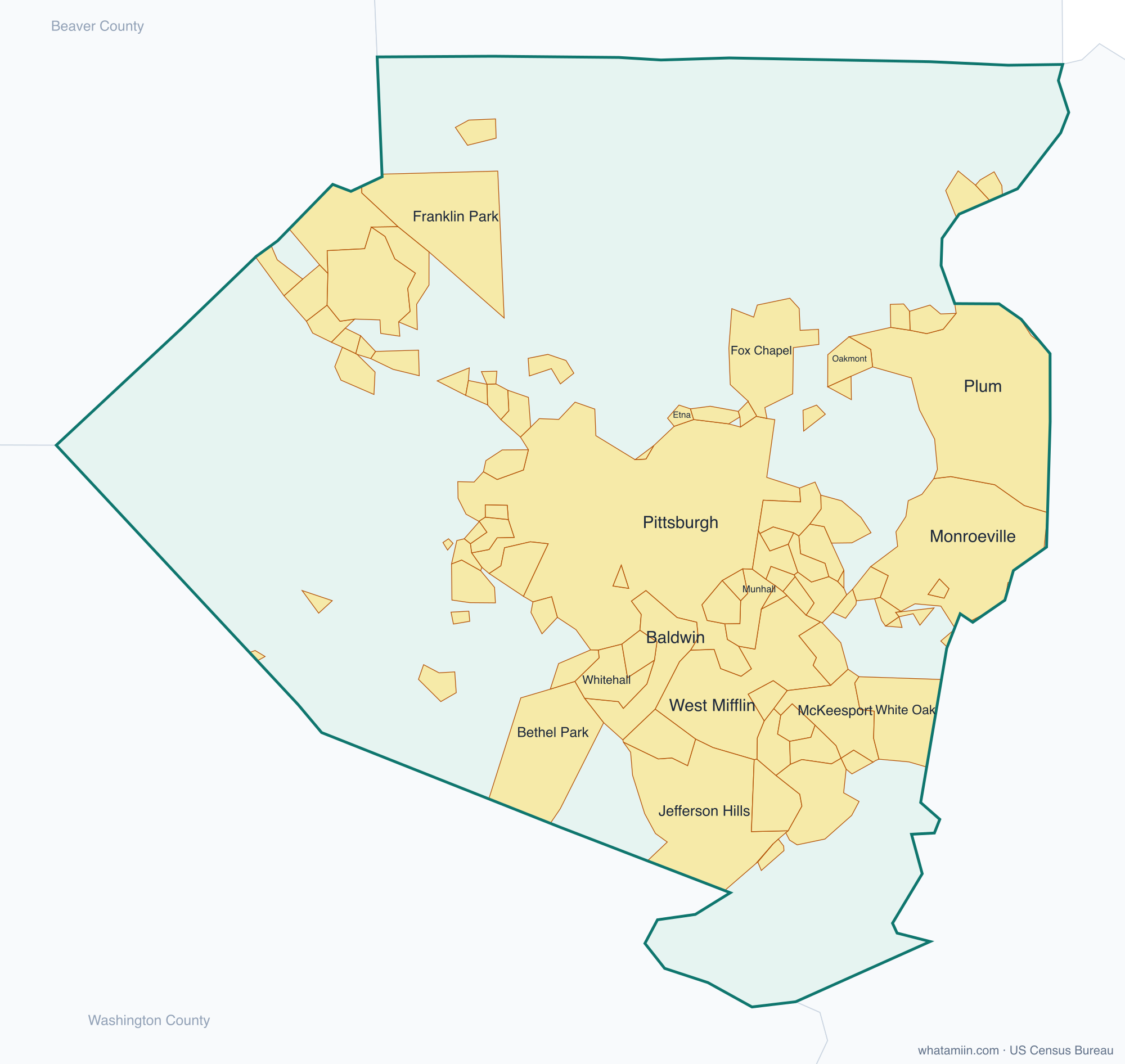
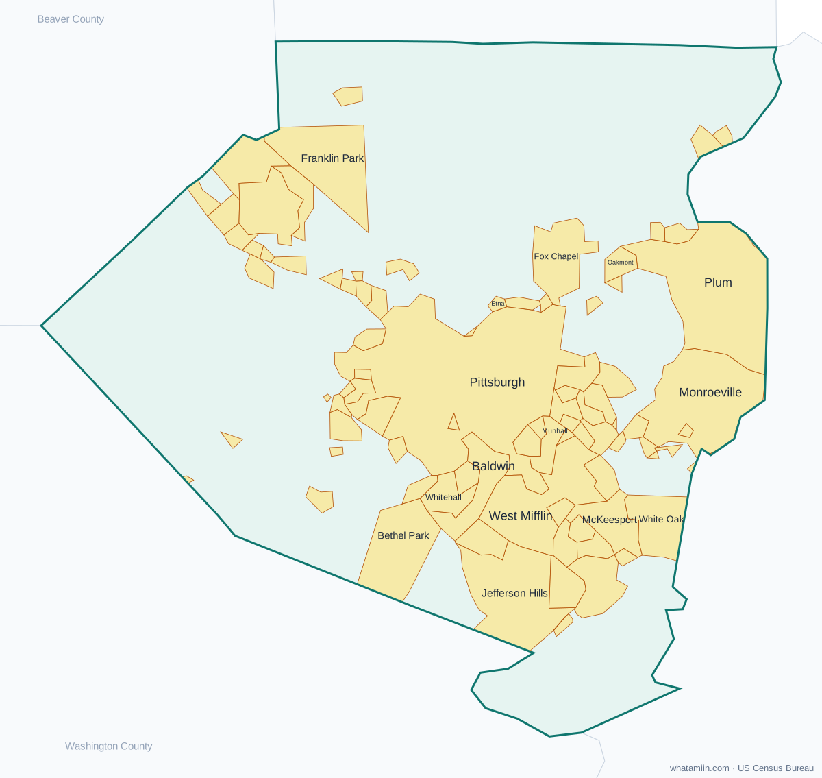
88 incorporated cities, towns and villages have land in Allegheny County, led by Pittsburgh with 307,668 residents inside the county. The rest of the county's people live in unincorporated areas, which the county governs directly.
| City or town | Population in county (2024) |
|---|---|
| Pittsburgh | 307,668 |
| Bethel Park | 32,376 |
| Monroeville | 27,966 |
| Plum | 26,420 |
| Baldwin | 20,712 |
| West Mifflin | 18,902 |
| McKeesport | 17,119 |
| Franklin Park | 15,079 |
| Whitehall | 14,678 |
| Wilkinsburg | 13,800 |
| Jefferson Hills | 12,291 |
| Munhall | 10,371 |
| Brentwood | 9,704 |
| Pleasant Hills | 8,318 |
| Swissvale | 8,280 |
| Castle Shannon | 8,094 |
| Bellevue | 7,996 |
| Dormont | 7,922 |
| Carnegie | 7,855 |
| White Oak | 7,352 |
| Oakmont | 6,628 |
| West View | 6,426 |
| Forest Hills | 6,186 |
| Clairton | 5,945 |
| Crafton | 5,863 |
| McKees Rocks | 5,694 |
| Coraopolis | 5,340 |
| Fox Chapel | 5,185 |
| Duquesne | 5,074 |
| Turtle Creek | 4,925 |
| Green Tree | 4,751 |
| Bridgeville | 4,620 |
| Avalon | 4,594 |
| Glassport | 4,298 |
| Tarentum | 4,183 |
| North Braddock | 4,149 |
| Sewickley | 3,770 |
| Port Vue | 3,562 |
| Etna | 3,304 |
| Springdale | 3,272 |
| Mount Oliver | 3,259 |
| Ingram | 3,256 |
| Millvale | 3,255 |
| Brackenridge | 3,125 |
| Sharpsburg | 3,063 |
| Churchill | 3,035 |
| Edgewood | 3,032 |
| Pitcairn | 2,984 |
| Homestead | 2,852 |
| Aspinwall | 2,803 |
| Emsworth | 2,426 |
| Verona | 2,403 |
| Liberty | 2,265 |
| East McKeesport | 1,991 |
| Rankin | 1,910 |
| East Pittsburgh | 1,855 |
| Ben Avon | 1,841 |
| West Homestead | 1,804 |
| Wilmerding | 1,719 |
| Braddock | 1,669 |
Showing the 60 largest of 88.
Townships and county subdivisions
Aleppo township, Aspinwall borough, Avalon borough, Baldwin borough, Baldwin township, Bell Acres borough, Bellevue borough, Ben Avon Heights borough, Ben Avon borough, Bethel Park municipality, Blawnox borough, Brackenridge borough, Braddock Hills borough, Braddock borough, Bradford Woods borough, Brentwood borough, Bridgeville borough, Carnegie borough, Castle Shannon borough, Chalfant borough, Cheswick borough, Churchill borough, Clairton city, Collier township, Coraopolis borough, Crafton borough, Crescent township, Dormont borough, Dravosburg borough, Duquesne city, East Deer township, East McKeesport borough, East Pittsburgh borough, Edgewood borough, Edgeworth borough, Elizabeth borough, Elizabeth township, Emsworth borough, Etna borough, Fawn township, Findlay township, Forest Hills borough, Forward township, Fox Chapel borough, Franklin Park borough, Frazer township, Glassport borough, Glen Osborne borough, Glenfield borough, Green Tree borough, Hampton township, Harmar township, Harrison township, Haysville borough, Heidelberg borough, Homestead borough, Indiana township, Ingram borough, Jefferson Hills borough, Kennedy township, Kilbuck township, Leet township, Leetsdale borough, Liberty borough, Lincoln borough, Marshall township, McCandless township, McDonald borough, McKees Rocks borough, McKeesport city, Millvale borough, Monroeville municipality, Moon township, Mount Lebanon township, Mount Oliver borough, Munhall borough, Neville township, North Braddock borough, North Fayette township, North Versailles township…
ZIP codes in Allegheny County
119 ZIP code areas include land in Allegheny County. 16 of them lie mostly in a neighboring county.
Mostly in Allegheny County: 15006, 15007, 15014, 15015, 15017, 15018, 15020, 15024, 15025, 15028, 15030, 15031, 15034, 15035, 15037, 15044, 15045, 15046, 15047, 15049, 15051, 15056, 15064, 15065, 15071, 15075, 15076, 15082, 15084, 15086, 15088, 15090, 15101, 15102, 15104, 15106, 15108, 15110, 15112, 15116, 15120, 15122, 15123, 15126, 15129, 15131, 15132, 15133, 15135, 15136, 15137, 15139, 15140, 15142, 15143, 15144, 15145, 15146, 15147, 15148, 15201, 15202, 15203, 15204, 15205, 15206, 15207, 15208, 15209, 15210, 15211, 15212, 15213, 15214, 15215, 15216, 15217, 15218, 15219, 15220, 15221, 15222, 15223, 15224, 15225, 15226, 15227, 15228, 15229, 15232, 15233, 15234, 15235, 15236, 15237, 15238, 15239, 15241, 15243, 15260, 15275, 15282, 15290
Partly in Allegheny County: 15003, 15005, 15026, 15057, 15063, 15068, 15083, 15085, 15089, 15321, 15332, 15642, 15668, 16046, 16055, 16059
Neighboring counties
Beaver County · Butler County · Washington County · Westmoreland County
See every county on the Pennsylvania county map or in the list of Pennsylvania counties, or find ZIP areas on the Pennsylvania ZIP code map. To check which county an exact address is in, use what county am I in.
More Pennsylvania county profiles: Montgomery County · Philadelphia County