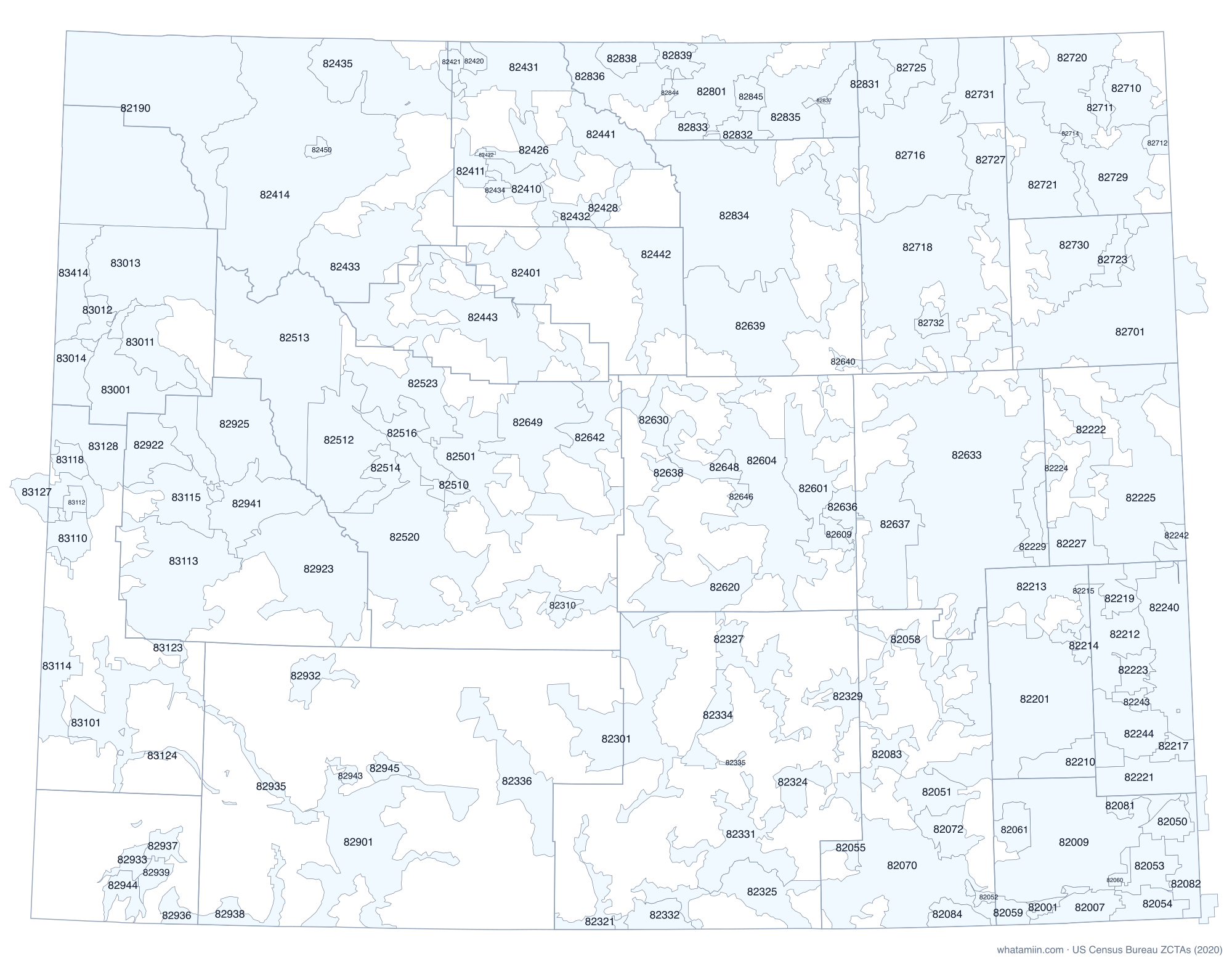
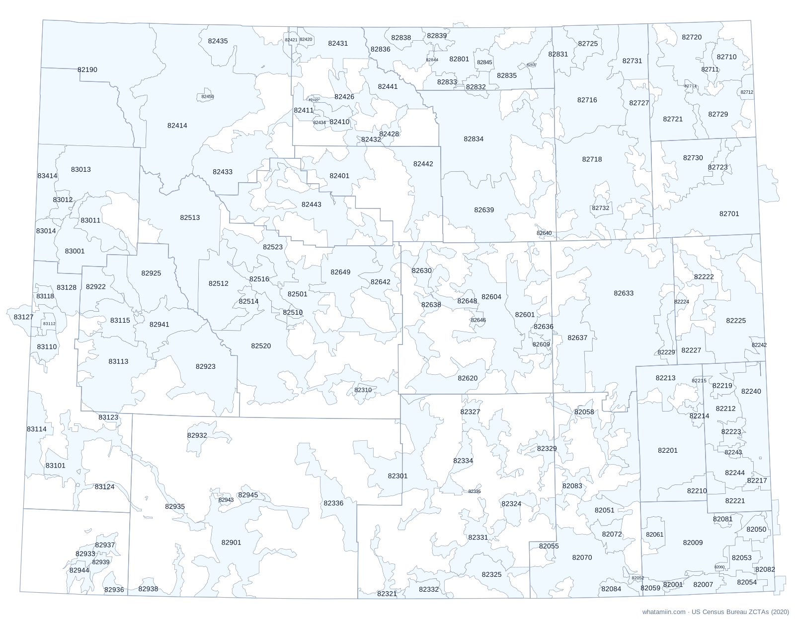
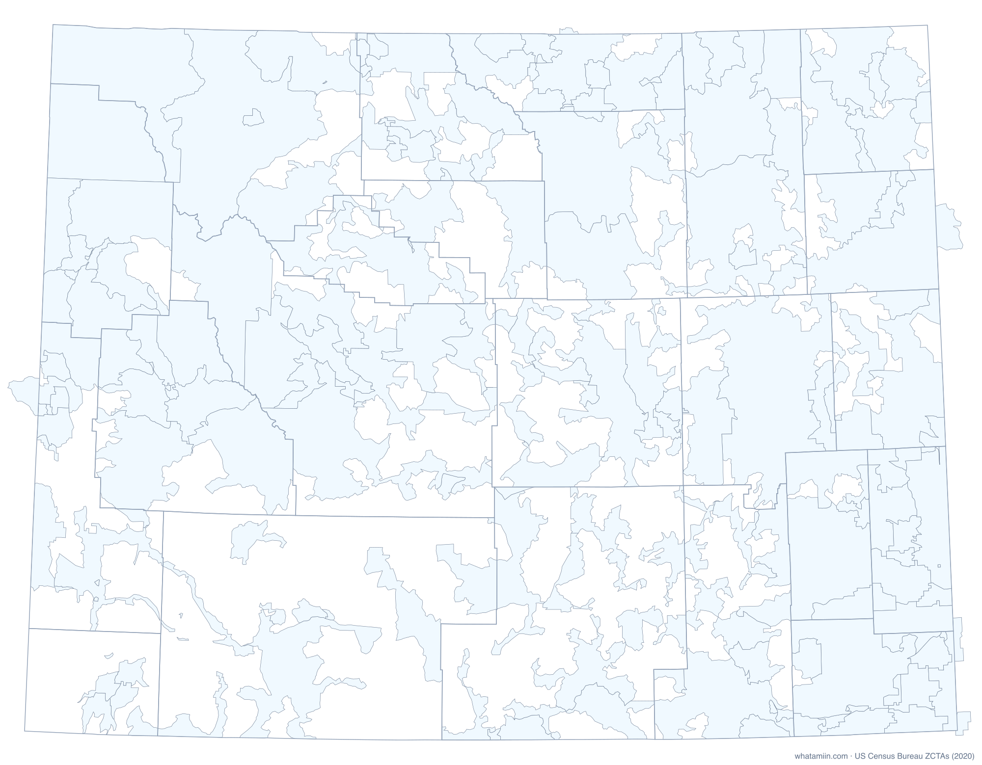
About Wyoming ZIP code areas
Wyoming has 176 ZIP code tabulation areas (ZCTAs), the Census Bureau's area version of ZIP codes. Lincoln County has the most, with 15. 29 of them cross a county line, which is why a ZIP code alone cannot always tell you the county. The largest by land is 82190 at 2,969.9 square miles.
ZIP codes are mail routes, so the Postal Service has no official boundary map. ZCTAs are built from the ZIP code most common in each census block in 2020. PO-box-only ZIPs and single-building ZIPs have no area and are not on this map. For the exact ZIP area at your location, use what ZIP code am I in.
All Wyoming ZIP codes
| ZIP | Main city or place | County | Land (sq mi) |
|---|---|---|---|
| 82001 | Cheyenne | Laramie | 55.1 |
| 82005 | Warren AFB (CDP) | Laramie | 2.6 |
| 82007 | Cheyenne | Laramie | 193.8 |
| 82009 | Ranchettes (CDP) | Laramie | 1,277.8 |
| 82050 | Albin town | Laramie | 135.3 |
| 82051 | Unincorporated | Albany | 229.3 |
| 82052 | Unincorporated | Albany | 23.5 |
| 82053 | Burns town | Laramie | 209.9 |
| 82054 | Carpenter (CDP) | Laramie | 184.9 |
| 82055 | Centennial (CDP) | Albany | 58.0 |
| 82058 | Unincorporated | Albany | 200.4 |
| 82059 | Unincorporated | Laramie | 84.9 |
| 82060 | Hillsdale (CDP) | Laramie | 41.6 |
| 82061 | Unincorporated | Laramie | 139.1 |
| 82070 | Laramie | Albany | 1,014.2 |
| 82072 | Laramie | Albany | 189.1 |
| 82073 | Unincorporated | Albany | 10.3 |
| 82081 | Unincorporated | Laramie | 93.4 |
| 82082 | Pine Bluffs town | Laramie, Banner, Kimball | 319.9 |
| 82083 | Arlington (CDP) | Albany, Carbon | 246.6 |
| 82084 | Unincorporated | Albany | 121.7 |
| 82190 | Mammoth (CDP) | Park, Teton | 2,969.9 |
| 82201 | Slater (CDP) | Platte, Albany | 1,658.8 |
| 82210 | Chugwater town | Platte, Goshen | 283.8 |
| 82212 | Fort Laramie town | Goshen | 360.9 |
| 82213 | Glendo town | Platte | 396.3 |
| 82214 | Guernsey town | Platte | 75.1 |
| 82215 | Hartville town | Platte | 60.8 |
| 82217 | Hawk Springs (CDP) | Goshen | 85.8 |
| 82218 | Huntley (CDP) | Goshen | 1.0 |
| 82219 | Unincorporated | Goshen | 161.7 |
| 82221 | LaGrange town | Goshen, Laramie | 326.7 |
| 82222 | Lance Creek (CDP) | Niobrara | 246.6 |
| 82223 | Lingle town | Goshen | 123.7 |
| 82224 | Lost Springs town | Converse, Niobrara | 102.2 |
| 82225 | Lance Creek (CDP) | Niobrara, Goshen | 1,113.5 |
| 82227 | Manville town | Niobrara | 248.9 |
| 82229 | Lost Springs town | Converse | 207.6 |
| 82240 | Torrington | Goshen | 664.7 |
| 82242 | Van Tassell town | Niobrara, Goshen | 96.7 |
| 82243 | Veteran (CDP) | Goshen | 50.3 |
| 82244 | Hawk Springs (CDP) | Goshen | 309.4 |
| 82301 | Rawlins | Carbon, Sweetwater | 933.3 |
| 82310 | Jeffrey City (CDP) | Fremont | 50.9 |
| 82321 | Baggs town | Carbon | 168.5 |
| 82322 | Bairoil town | Sweetwater | 5.3 |
| 82323 | Dixon town | Carbon | 15.3 |
| 82324 | Elk Mountain town | Carbon | 163.3 |
| 82325 | Encampment town | Carbon | 438.3 |
| 82327 | Hanna town | Carbon | 310.0 |
| 82329 | Medicine Bow town | Carbon, Albany | 315.0 |
| 82331 | Saratoga town | Carbon | 509.6 |
| 82332 | Unincorporated | Carbon | 153.5 |
| 82334 | Sinclair town | Carbon | 163.1 |
| 82335 | Unincorporated | Carbon | 12.0 |
| 82336 | Wamsutter town | Sweetwater | 484.2 |
| 82401 | Worland | Washakie, Hot Springs, Big Horn | 563.7 |
| 82410 | Basin town | Big Horn | 155.8 |
| 82411 | Burlington town | Big Horn | 133.3 |
| 82412 | Byron town | Big Horn | 13.3 |
| 82414 | Cody | Park | 2,706.9 |
| 82420 | Cowley town | Big Horn | 53.2 |
| 82421 | Deaver town | Big Horn, Park | 74.3 |
| 82422 | Unincorporated | Big Horn | 10.9 |
| 82423 | Frannie town | Big Horn, Park | 12.4 |
| 82426 | Greybull town | Big Horn | 279.6 |
| 82428 | Hyattville (CDP) | Big Horn | 101.4 |
| 82430 | Kirby town | Hot Springs | 3.7 |
| 82431 | Lovell town | Big Horn | 479.9 |
| 82432 | Manderson town | Big Horn | 136.1 |
| 82433 | Meeteetse town | Park | 763.2 |
| 82434 | Unincorporated | Big Horn | 49.7 |
| 82435 | Ralston (CDP) | Park, Big Horn | 774.8 |
| 82440 | Ralston (CDP) | Park | 0.6 |
| 82441 | Shell (CDP) | Big Horn | 372.8 |
| 82442 | Ten Sleep town | Washakie | 614.6 |
| 82443 | Lucerne (CDP) | Hot Springs | 1,053.9 |
| 82450 | Unincorporated | Park | 34.2 |
| 82501 | Arapahoe (CDP) | Fremont | 694.2 |
| 82510 | Ethete (CDP) | Fremont | 63.9 |
| 82512 | Crowheart (CDP) | Fremont | 697.9 |
| 82513 | Dubois town | Fremont | 1,444.5 |
| 82514 | Fort Washakie (CDP) | Fremont | 161.1 |
| 82515 | Hudson town | Fremont | 8.8 |
| 82516 | Johnstown (CDP) | Fremont | 274.8 |
| 82520 | Boulder Flats (CDP) | Fremont | 1,493.5 |
| 82523 | Pavillion town | Fremont | 476.6 |
| 82601 | Casper Mountain (CDP) | Natrona | 478.8 |
| 82604 | Casper | Natrona | 1,048.4 |
| 82609 | Casper | Natrona | 65.2 |
| 82620 | Alcova (CDP) | Natrona, Carbon | 410.4 |
| 82630 | Unincorporated | Natrona | 186.3 |
| 82633 | Douglas | Converse, Niobrara | 2,575.5 |
| 82635 | Edgerton town | Natrona | 7.0 |
| 82636 | Evansville town | Natrona, Converse | 133.5 |
| 82637 | Glenrock town | Converse | 637.7 |
| 82638 | Unincorporated | Natrona | 69.1 |
| 82639 | Kaycee town | Johnson, Natrona | 1,117.9 |
| 82640 | Unincorporated | Johnson | 25.5 |
| 82642 | Unincorporated | Fremont, Natrona | 355.7 |
| 82643 | Midwest town | Natrona | 14.3 |
| 82644 | Mills town | Natrona | 0.8 |
| 82646 | Unincorporated | Natrona | 51.5 |
| 82648 | Powder River (CDP) | Natrona | 188.2 |
| 82649 | Shoshoni town | Fremont | 588.2 |
| 82701 | Newcastle | Weston, Niobrara, Campbell | 1,798.5 |
| 82710 | Unincorporated | Crook | 278.9 |
| 82711 | Unincorporated | Crook | 95.2 |
| 82712 | Beulah (CDP) | Crook | 78.3 |
| 82714 | Unincorporated | Crook | 23.0 |
| 82716 | Gillette | Campbell | 1,182.7 |
| 82718 | Gillette | Campbell | 1,596.7 |
| 82720 | Hulett town | Crook | 615.5 |
| 82721 | Pine Haven town | Crook | 696.8 |
| 82723 | Osage (CDP) | Weston | 136.8 |
| 82725 | Unincorporated | Campbell | 228.6 |
| 82727 | Unincorporated | Campbell, Crook | 432.4 |
| 82729 | Sundance town | Crook, Weston | 536.4 |
| 82730 | Upton town | Weston, Crook | 601.0 |
| 82731 | Unincorporated | Campbell | 408.7 |
| 82732 | Wright town | Campbell | 76.9 |
| 82801 | Sheridan | Sheridan, Big Horn | 526.7 |
| 82831 | Arvada (CDP) | Campbell, Sheridan, Johnson | 594.9 |
| 82832 | Story (CDP) | Sheridan, Johnson | 134.9 |
| 82833 | Big Horn (CDP) | Sheridan | 119.7 |
| 82834 | Buffalo | Johnson | 1,686.2 |
| 82835 | Clearmont town | Sheridan | 511.1 |
| 82836 | Dayton town | Sheridan | 392.6 |
| 82837 | Unincorporated | Sheridan | 14.6 |
| 82838 | Parkman (CDP) | Sheridan | 149.1 |
| 82839 | Ranchester town | Sheridan | 111.5 |
| 82842 | Story (CDP) | Sheridan | 9.0 |
| 82844 | Unincorporated | Sheridan | 28.9 |
| 82845 | Unincorporated | Sheridan | 87.3 |
| 82901 | Rock Springs | Sweetwater | 1,077.5 |
| 82922 | Bondurant (CDP) | Sublette | 299.6 |
| 82923 | Boulder (CDP) | Sublette | 998.8 |
| 82925 | Cora (CDP) | Sublette, Teton | 705.1 |
| 82929 | Little America (CDP) | Sweetwater | 3.1 |
| 82932 | Farson (CDP) | Sweetwater | 160.4 |
| 82933 | Fort Bridger (CDP) | Uinta | 77.1 |
| 82934 | Granger town | Sweetwater | 7.2 |
| 82935 | Green River | Sweetwater | 134.3 |
| 82936 | Lonetree (CDP) | Uinta | 78.6 |
| 82937 | Urie (CDP) | Uinta | 88.6 |
| 82938 | McKinnon (CDP) | Sweetwater | 149.8 |
| 82939 | Carter (CDP) | Uinta | 78.3 |
| 82941 | Pinedale town | Sublette | 668.4 |
| 82942 | Point of Rocks (CDP) | Sweetwater | 9.8 |
| 82943 | Reliance (CDP) | Sweetwater | 39.1 |
| 82944 | Robertson (CDP) | Uinta | 120.5 |
| 82945 | Superior town | Sweetwater | 68.4 |
| 83001 | Hoback (CDP) | Teton | 481.4 |
| 83011 | Kelly (CDP) | Teton | 332.5 |
| 83012 | Unincorporated | Teton | 142.3 |
| 83013 | Unincorporated | Teton | 890.2 |
| 83014 | Wilson (CDP) | Teton | 214.2 |
| 83025 | Teton Village (CDP) | Teton | 13.9 |
| 83101 | Kemmerer | Lincoln | 530.1 |
| 83110 | Afton town | Lincoln | 151.6 |
| 83111 | Auburn (CDP) | Lincoln | 15.0 |
| 83112 | Turnerville (CDP) | Lincoln | 57.0 |
| 83113 | Marbleton town | Sublette | 959.6 |
| 83114 | Taylor (CDP) | Lincoln | 351.7 |
| 83115 | Daniel (CDP) | Sublette | 338.4 |
| 83116 | Kemmerer | Lincoln | 2.9 |
| 83118 | Nordic (CDP) | Lincoln | 93.1 |
| 83119 | Fairview (CDP) | Lincoln | 13.3 |
| 83121 | Kemmerer | Lincoln | 2.9 |
| 83122 | Grover (CDP) | Lincoln | 7.4 |
| 83123 | La Barge town | Lincoln | 45.8 |
| 83124 | Opal town | Lincoln | 32.5 |
| 83126 | Smoot (CDP) | Lincoln | 11.5 |
| 83127 | Star Valley Ranch town | Lincoln, Caribou | 231.1 |
| 83128 | Alpine Northeast (CDP) | Lincoln | 371.6 |
| 83414 | Alta (CDP) | Teton | 342.7 |
Download as CSV. County order shows where most of the ZIP's land lies.
See also: Wyoming county map · Wyoming counties · ZIP codes in a radius · study: ZIP codes that cross county lines