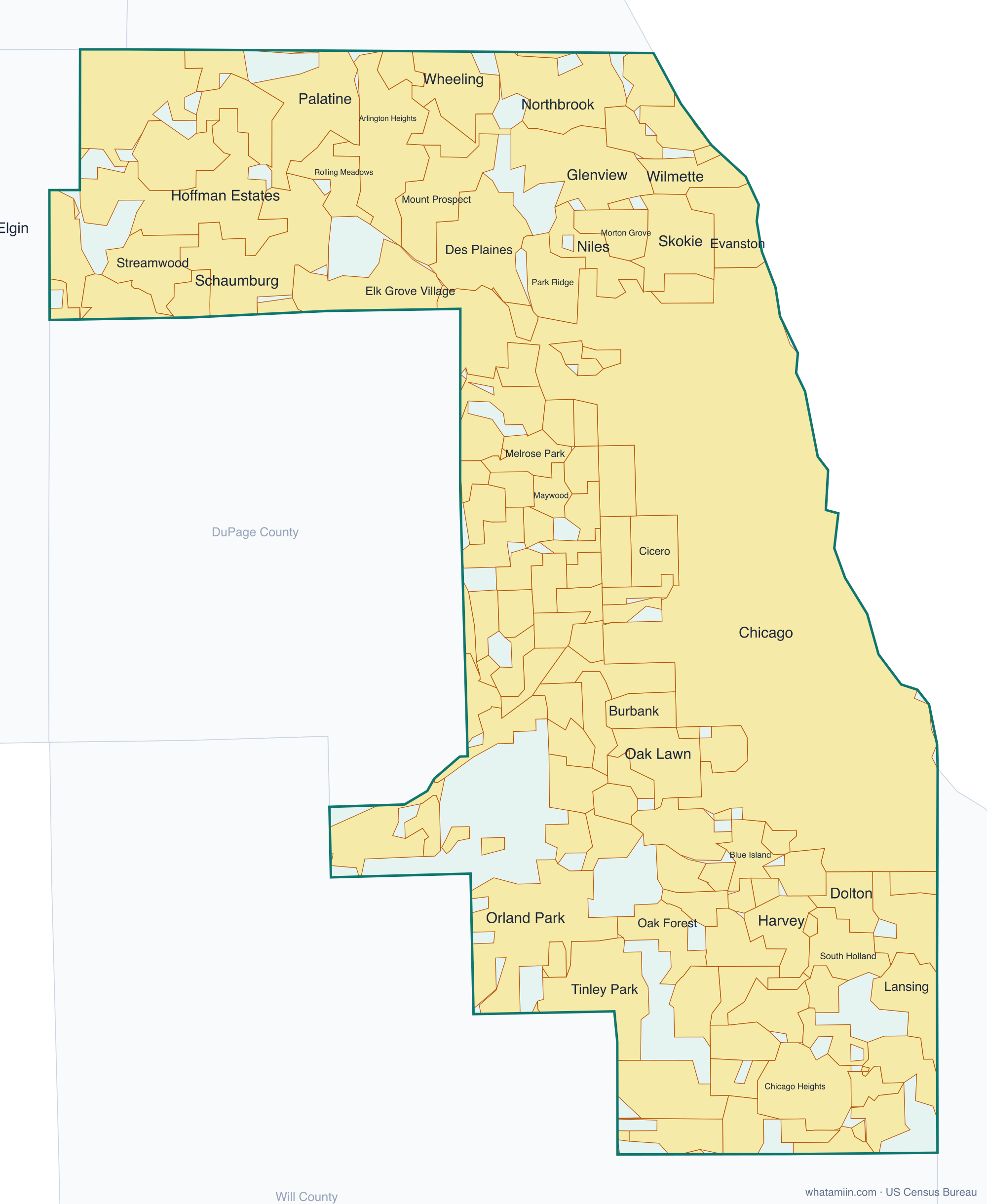
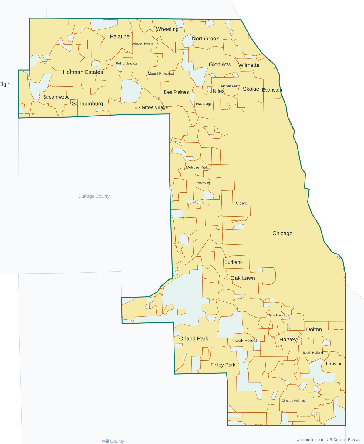
Cook County at a glance
| County seat | Chicago |
|---|---|
| Population (2024) | 5,182,617 · 1st of 102 in Illinois |
| Change since 2020 | -1.8% |
| Land area | 945 sq mi |
| Density | 5,485 people per sq mi |
| Time zone | Central |
| Elevation | 558 ft to 942 ft (median 643 ft) |
| FIPS code | 17031 |
Cities and towns in Cook County
137 incorporated cities, towns and villages have land in Cook County, led by Chicago with 2,721,308 residents inside the county. The rest of the county's people live in unincorporated areas, which the county governs directly.
| City or town | Population in county (2024) |
|---|---|
| Chicago | 2,721,308 |
| Cicero | 82,090 |
| Schaumburg | 77,099 |
| Evanston | 76,006 |
| Arlington Heights | 75,596 |
| Palatine | 65,951 |
| Skokie | 65,850 |
| Des Plaines | 58,832 |
| Orland Park | 57,660 |
| Oak Lawn | 56,531 |
| Mount Prospect | 55,460 |
| Berwyn | 55,152 |
| Oak Park | 52,947 |
| Hoffman Estates | 50,920 |
| Glenview | 47,634 |
| Tinley Park | 47,182 |
| Park Ridge | 38,445 |
| Streamwood | 38,360 |
| Wheeling | 38,329 |
| Calumet City | 34,855 |
| Northbrook | 34,546 |
| Elk Grove Village | 31,802 |
| Niles | 29,918 |
| Burbank | 28,606 |
| Lansing | 28,107 |
| Wilmette | 27,443 |
| Oak Forest | 26,813 |
| Chicago Heights | 26,533 |
| Elgin | 24,485 |
| Morton Grove | 24,467 |
| Melrose Park | 23,999 |
| Rolling Meadows | 23,732 |
| Elmwood Park | 23,698 |
| Maywood | 23,364 |
| Blue Island | 21,805 |
| South Holland | 20,775 |
| Dolton | 20,697 |
| Harvey | 19,781 |
| Hanover Park | 19,422 |
| Evergreen Park | 19,301 |
| Brookfield | 18,885 |
| Homewood | 18,789 |
| Matteson | 18,566 |
| Alsip | 18,486 |
| Lemont | 18,195 |
| Bellwood | 18,132 |
| Franklin Park | 18,110 |
| Palos Hills | 18,026 |
| Park Forest | 17,858 |
| Bartlett | 16,841 |
| Bridgeview | 16,559 |
| Westchester | 16,313 |
| Country Club Hills | 16,238 |
| La Grange | 15,943 |
| Prospect Heights | 15,566 |
| Norridge | 14,817 |
| Hickory Hills | 14,118 |
| Chicago Ridge | 14,036 |
| Midlothian | 13,870 |
| Forest Park | 13,846 |
Showing the 60 largest of 137.
Townships and county subdivisions
Barrington township, Berwyn township, Bloom township, Bremen township, Calumet township, Chicago city, Cicero township, Elk Grove township, Evanston city, Hanover township, Lemont township, Leyden township, Lyons township, Maine township, New Trier township, Niles township, Northfield township, Norwood Park township, Oak Park township, Orland township, Palatine township, Palos township, Proviso township, Rich township, River Forest township, Riverside township, Schaumburg township, Stickney township, Thornton township, Wheeling township, Worth township
ZIP codes in Cook County
178 ZIP code areas include land in Cook County. 11 of them lie mostly in a neighboring county.
Mostly in Cook County: 60004, 60005, 60007, 60008, 60010, 60016, 60018, 60022, 60025, 60026, 60029, 60043, 60053, 60056, 60062, 60067, 60068, 60070, 60074, 60076, 60077, 60090, 60091, 60093, 60104, 60107, 60120, 60130, 60131, 60141, 60153, 60154, 60155, 60160, 60162, 60163, 60164, 60165, 60169, 60171, 60173, 60176, 60192, 60193, 60194, 60195, 60201, 60202, 60203, 60208, 60301, 60302, 60304, 60305, 60402, 60406, 60409, 60411, 60415, 60418, 60419, 60422, 60425, 60426, 60428, 60429, 60430, 60438, 60439, 60443, 60445, 60452, 60453, 60455, 60456, 60457, 60458, 60459, 60461, 60462, 60463, 60464, 60465, 60466, 60467, 60469, 60471, 60472, 60473, 60475, 60476, 60477, 60478, 60480, 60482, 60487, 60501, 60513, 60525, 60526, 60534, 60546, 60558, 60601, 60602, 60603, 60604, 60605, 60606, 60607, 60608, 60609, 60610, 60611, 60612, 60613, 60614, 60615, 60616, 60617, 60618, 60619, 60620, 60621, 60622, 60623, 60624, 60625, 60626, 60628, 60629, 60630, 60631, 60632, 60633, 60634, 60636, 60637, 60638, 60639, 60640, 60641, 60642, 60643, 60644, 60645, 60646, 60647, 60649, 60651, 60652, 60653, 60654, 60655, 60656, 60657, 60659, 60660, 60661, 60706, 60707, 60712, 60714, 60803, 60804, 60805, 60827
Partly in Cook County: 60015, 60089, 60103, 60126, 60133, 60172, 60423, 60449, 60521, 60523, 60527
Neighboring counties
DuPage County · Kane County · Lake County · McHenry County · Will County · Lake County, IN · Porter County, IN · Berrien County, MI
See every county on the Illinois county map or in the list of Illinois counties, or find ZIP areas on the Illinois ZIP code map. To check which county an exact address is in, use what county am I in.
More Illinois county profiles: DuPage County · Lake County · Will County