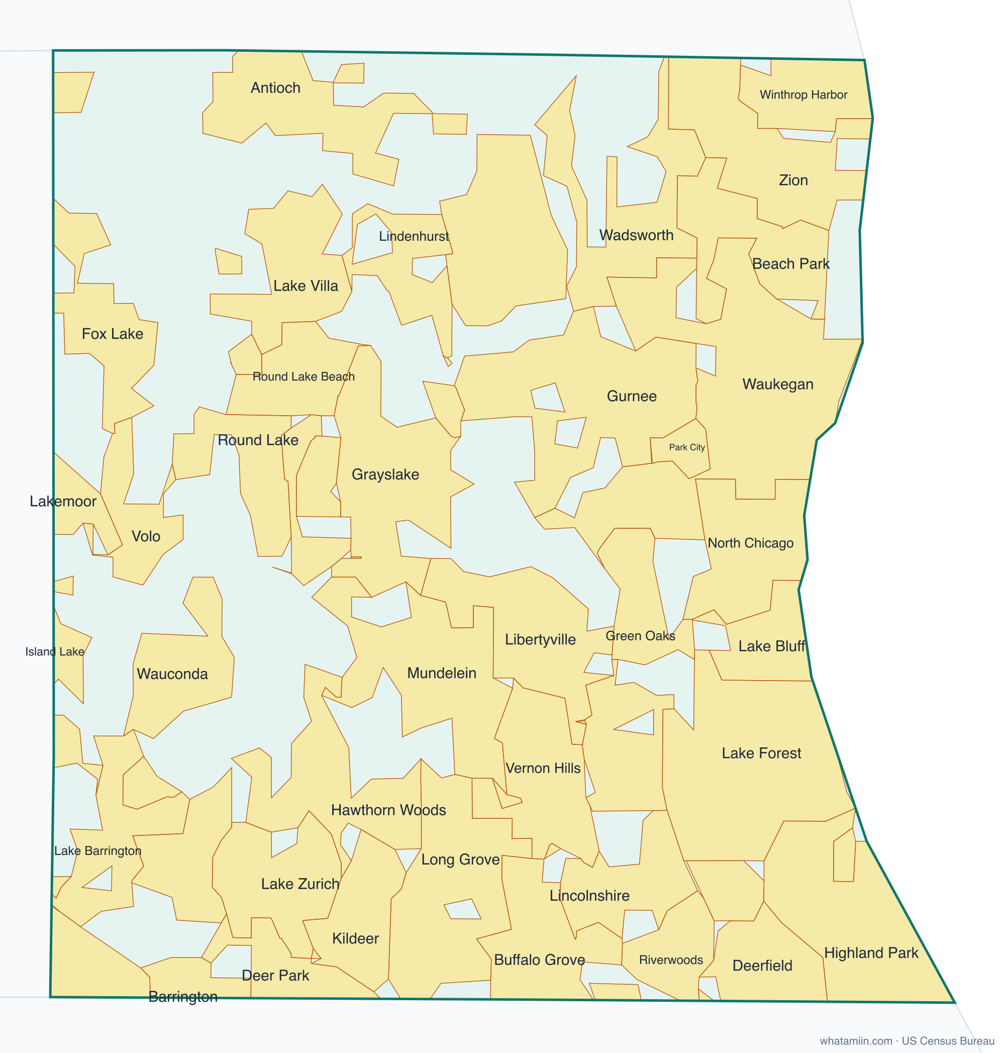
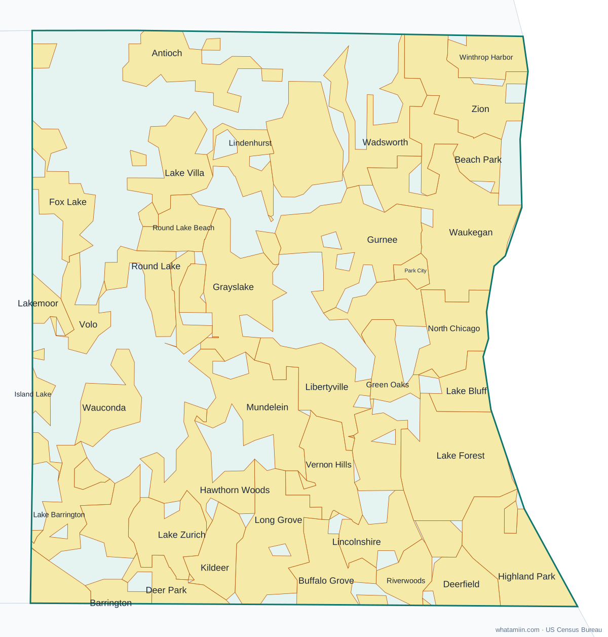
Lake County at a glance
| County seat | Waukegan |
|---|---|
| Population (2024) | 718,604 · 3rd of 102 in Illinois |
| Change since 2020 | +0.6% |
| Land area | 444 sq mi |
| Density | 1,620 people per sq mi |
| Time zone | Central |
| Elevation | 584 ft to 889 ft (median 748 ft) |
| FIPS code | 17097 |
Cities and towns in Lake County
52 incorporated cities, towns and villages have land in Lake County, led by Waukegan with 88,570 residents inside the county. The rest of the county's people live in unincorporated areas, which the county governs directly.
| City or town | Population in county (2024) |
|---|---|
| Waukegan | 88,570 |
| Mundelein | 32,641 |
| Highland Park | 30,794 |
| North Chicago | 30,639 |
| Gurnee | 30,546 |
| Buffalo Grove | 29,563 |
| Round Lake Beach | 27,091 |
| Vernon Hills | 27,002 |
| Zion | 24,583 |
| Grayslake | 21,262 |
| Libertyville | 20,643 |
| Lake Zurich | 19,960 |
| Lake Forest | 19,642 |
| Deerfield | 18,670 |
| Round Lake | 18,654 |
| Antioch | 15,108 |
| Lindenhurst | 14,564 |
| Beach Park | 14,212 |
| Wauconda | 14,055 |
| Fox Lake | 10,286 |
| Hawthorn Woods | 9,584 |
| Lake Villa | 8,737 |
| Long Grove | 8,393 |
| Lincolnshire | 8,008 |
| Park City | 7,940 |
| Round Lake Park | 7,836 |
| Volo | 7,361 |
| Winthrop Harbor | 6,565 |
| Lake Bluff | 5,600 |
| Highwood | 5,358 |
| Lake Barrington | 5,160 |
| Barrington | 4,875 |
| Kildeer | 4,554 |
| Green Oaks | 4,107 |
| Lakemoor | 3,890 |
| Riverwoods | 3,784 |
| Deer Park | 3,650 |
| Hainesville | 3,532 |
| Wadsworth | 3,502 |
| Island Lake | 3,368 |
| North Barrington | 3,142 |
| Round Lake Heights | 2,599 |
| Bannockburn | 1,377 |
| Tower Lakes | 1,213 |
| Third Lake | 1,114 |
| Barrington Hills | 599 |
| Mettawa | 562 |
| Indian Creek | 535 |
| Port Barrington | 531 |
| Fox River Grove | 492 |
| Old Mill Creek | 160 |
| Wheeling | 0 |
Townships and county subdivisions
Antioch township, Avon township, Benton township, Cuba township, Ela township, Fremont township, Grant township, Lake Villa township, Libertyville township, Moraine township, Newport township, Shields township, Vernon township, Warren township, Wauconda township, Waukegan township, West Deerfield township, Zion township
ZIP codes in Lake County
36 ZIP code areas include land in Lake County. 8 of them lie mostly in a neighboring county.
Mostly in Lake County: 60002, 60015, 60020, 60030, 60031, 60035, 60040, 60041, 60042, 60044, 60045, 60046, 60047, 60048, 60060, 60061, 60064, 60069, 60073, 60075, 60083, 60084, 60085, 60087, 60088, 60089, 60096, 60099
Partly in Lake County: 60010, 60013, 60021, 60050, 60051, 60074, 60081, 60090
Neighboring counties
Cook County · McHenry County · Allegan County, MI · Berrien County, MI · Van Buren County, MI · Kenosha County, WI
See every county on the Illinois county map or in the list of Illinois counties, or find ZIP areas on the Illinois ZIP code map. To check which county an exact address is in, use what county am I in.
More Illinois county profiles: Cook County · DuPage County · Will County