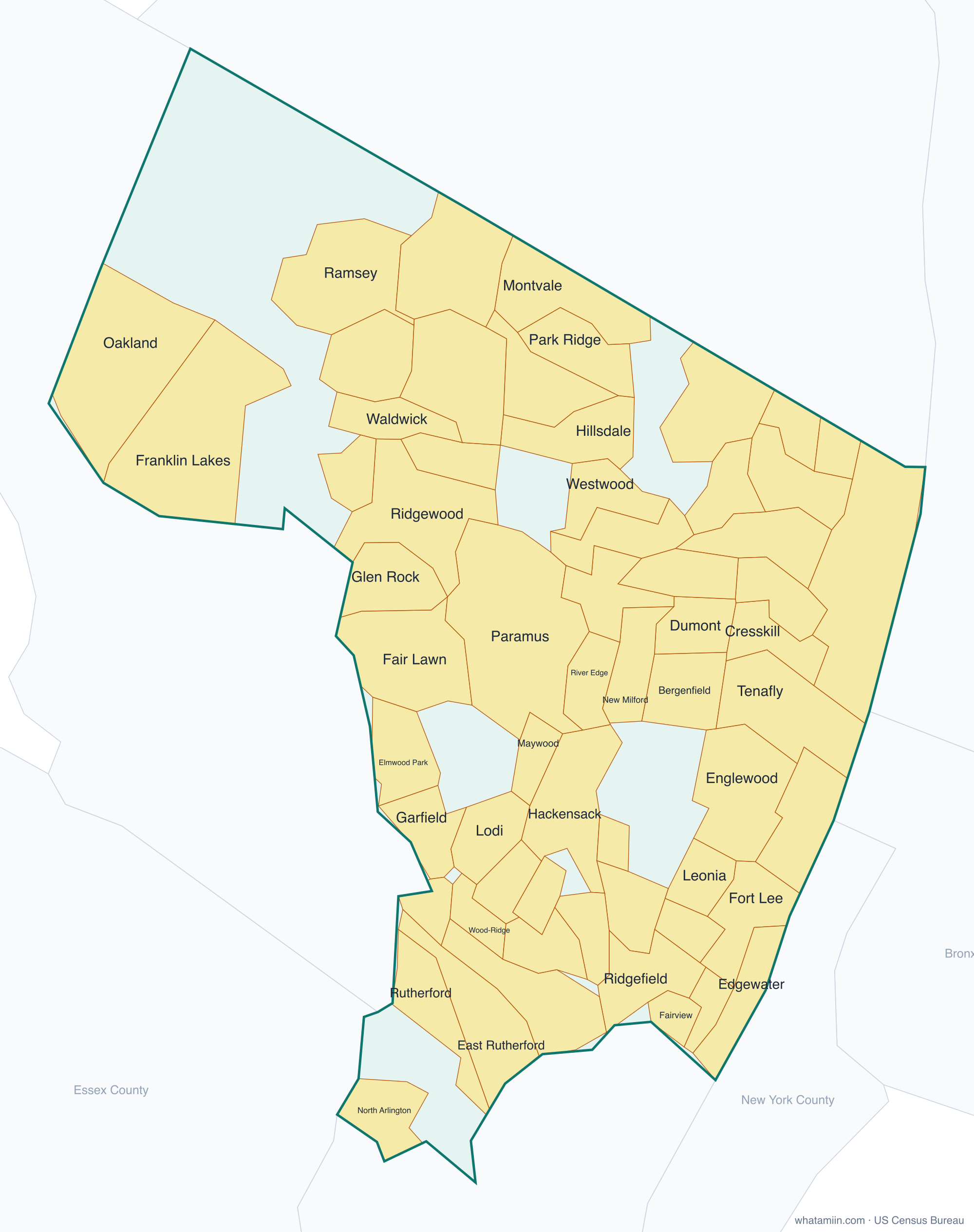
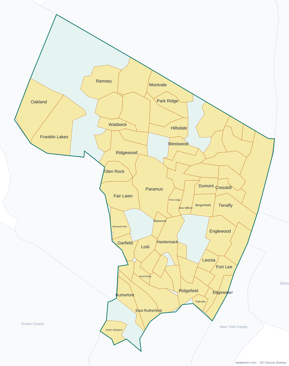
Bergen County at a glance
| County seat | Hackensack |
|---|---|
| Population (2024) | 978,641 · 1st of 21 in New Jersey |
| Change since 2020 | +2.4% |
| Land area | 233 sq mi |
| Density | 4,204 people per sq mi |
| Time zone | Eastern |
| Elevation | -472 ft to 1,099 ft (median 115 ft) |
| FIPS code | 34003 |
Cities and towns in Bergen County
61 incorporated cities, towns and villages have land in Bergen County, led by Hackensack with 46,630 residents inside the county. The rest of the county's people live in unincorporated areas, which the county governs directly.
| City or town | Population in county (2024) |
|---|---|
| Hackensack | 46,630 |
| Fort Lee | 40,566 |
| Fair Lawn | 36,489 |
| Garfield | 33,530 |
| Englewood | 30,221 |
| Bergenfield | 28,921 |
| Paramus | 26,786 |
| Ridgewood | 26,701 |
| Lodi | 26,358 |
| Cliffside Park | 26,183 |
| Elmwood Park | 21,680 |
| Palisades Park | 20,520 |
| Rutherford | 19,214 |
| Dumont | 18,606 |
| New Milford | 17,229 |
| North Arlington | 16,694 |
| Fairview | 15,606 |
| Tenafly | 15,455 |
| Edgewater | 15,116 |
| Ramsey | 15,003 |
| Ridgefield Park | 13,400 |
| Oakland | 12,926 |
| Glen Rock | 12,346 |
| Hasbrouck Heights | 12,253 |
| River Edge | 12,235 |
| Wallington | 12,060 |
| Ridgefield | 11,666 |
| Westwood | 11,434 |
| Franklin Lakes | 11,251 |
| Little Ferry | 11,137 |
| East Rutherford | 10,624 |
| Wood-Ridge | 10,397 |
| Waldwick | 10,308 |
| Hillsdale | 10,266 |
| Maywood | 10,221 |
| Bogota | 9,799 |
| Montvale | 9,663 |
| Park Ridge | 9,634 |
| Leonia | 9,492 |
| Cresskill | 9,311 |
| Closter | 8,730 |
| Upper Saddle River | 8,696 |
| Oradell | 8,344 |
| Emerson | 7,413 |
| Midland Park | 7,104 |
| Allendale | 6,928 |
| Carlstadt | 6,454 |
| Old Tappan | 6,342 |
| Woodcliff Lake | 6,234 |
| Norwood | 5,854 |
| Englewood Cliffs | 5,443 |
| Harrington Park | 5,088 |
| Northvale | 4,979 |
| Demarest | 4,941 |
| Ho-Ho-Kus | 4,342 |
| Haworth | 3,450 |
| Saddle River | 3,443 |
| Moonachie | 3,168 |
| Alpine | 1,774 |
| Rockleigh | 406 |
Showing the 60 largest of 61.
Townships and county subdivisions
Allendale borough, Alpine borough, Bergenfield borough, Bogota borough, Carlstadt borough, Cliffside Park borough, Closter borough, Cresskill borough, Demarest borough, Dumont borough, East Rutherford borough, Edgewater borough, Elmwood Park borough, Emerson borough, Englewood Cliffs borough, Englewood city, Fair Lawn borough, Fairview borough, Fort Lee borough, Franklin Lakes borough, Garfield city, Glen Rock borough, Hackensack city, Harrington Park borough, Hasbrouck Heights borough, Haworth borough, Hillsdale borough, Ho-Ho-Kus borough, Leonia borough, Little Ferry borough, Lodi borough, Lyndhurst township, Mahwah township, Maywood borough, Midland Park borough, Montvale borough, Moonachie borough, New Milford borough, North Arlington borough, Northvale borough, Norwood borough, Oakland borough, Old Tappan borough, Oradell borough, Palisades Park borough, Paramus borough, Park Ridge borough, Ramsey borough, Ridgefield Park village, Ridgefield borough, Ridgewood village, River Edge borough, River Vale township, Rochelle Park township, Rockleigh borough, Rutherford borough, Saddle Brook township, Saddle River borough, South Hackensack township, Teaneck township, Tenafly borough, Teterboro borough, Upper Saddle River borough, Waldwick borough, Wallington borough, Washington township, Westwood borough, Wood-Ridge borough, Woodcliff Lake borough, Wyckoff township
ZIP codes in Bergen County
66 ZIP code areas include land in Bergen County.
Mostly in Bergen County: 07010, 07020, 07022, 07024, 07026, 07031, 07057, 07070, 07071, 07072, 07073, 07074, 07075, 07401, 07407, 07410, 07417, 07423, 07430, 07432, 07436, 07446, 07450, 07452, 07458, 07463, 07481, 07601, 07603, 07604, 07605, 07606, 07607, 07608, 07620, 07621, 07624, 07626, 07627, 07628, 07630, 07631, 07632, 07640, 07641, 07642, 07643, 07644, 07645, 07646, 07647, 07648, 07649, 07650, 07652, 07656, 07657, 07660, 07661, 07662, 07663, 07666, 07670, 07675, 07676, 07677
Neighboring counties
Essex County · Hudson County · Passaic County · Bronx County, NY · New York County, NY · Rockland County, NY · Westchester County, NY
See every county on the New Jersey county map or in the list of New Jersey counties, or find ZIP areas on the New Jersey ZIP code map. To check which county an exact address is in, use what county am I in.
More New Jersey county profiles: Essex County · Hudson County · Middlesex County