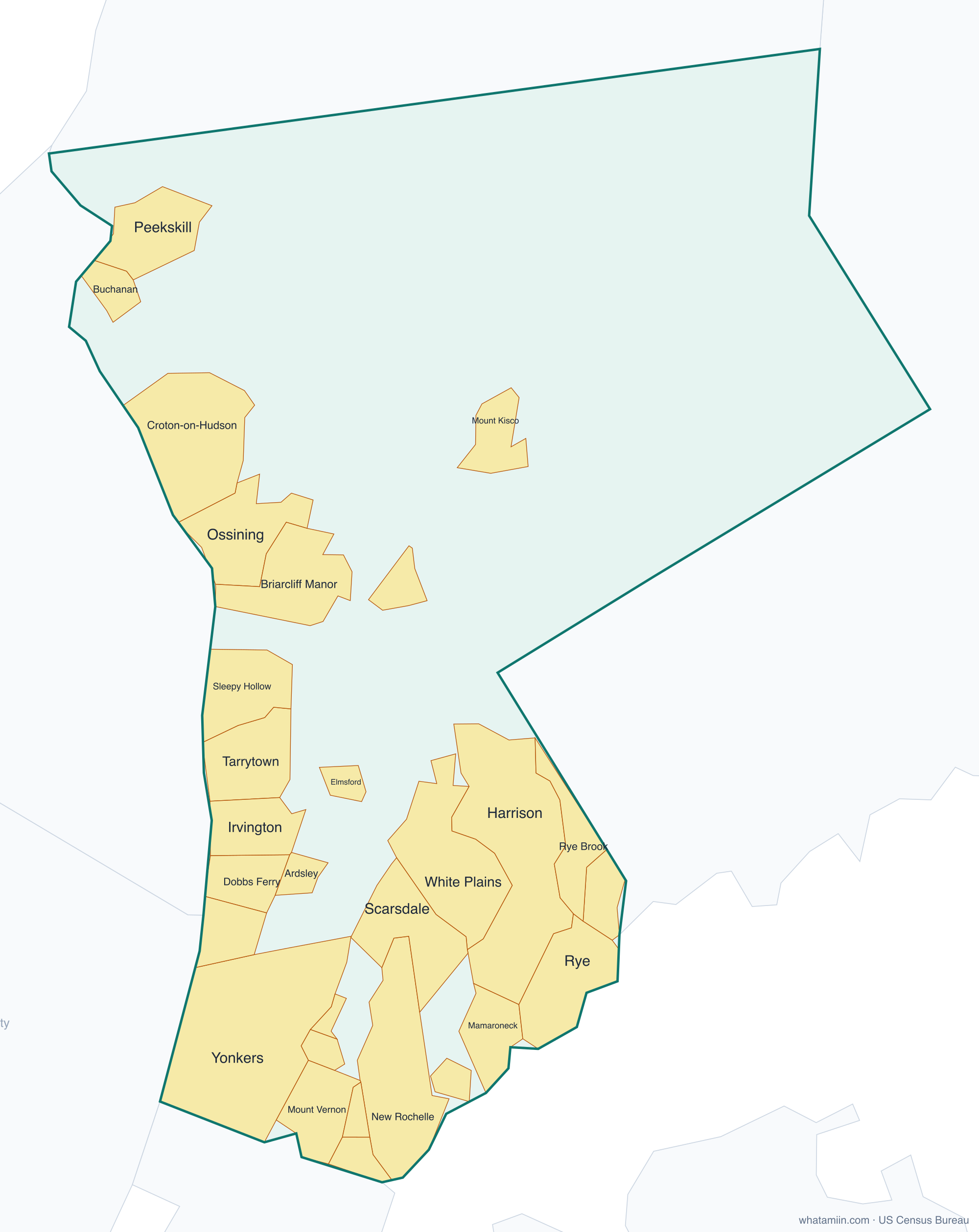
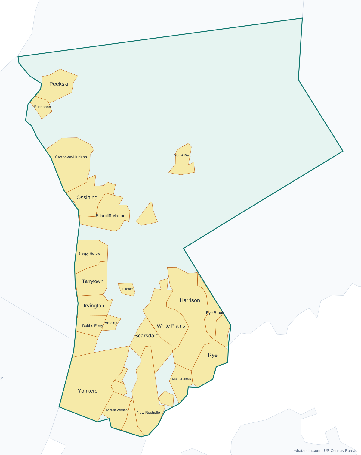
Westchester County at a glance
| County seat | White Plains |
|---|---|
| Population (2024) | 1,006,447 · 7th of 62 in New York |
| Change since 2020 | +0.2% |
| Land area | 431 sq mi |
| Density | 2,336 people per sq mi |
| Time zone | Eastern |
| Elevation | -62 ft to 912 ft (median 374 ft) |
| FIPS code | 36119 |
Cities and towns in Westchester County
29 incorporated cities, towns and villages have land in Westchester County, led by Yonkers with 211,040 residents inside the county. The rest of the county's people live in unincorporated areas, which the county governs directly.
| City or town | Population in county (2024) |
|---|---|
| Yonkers | 211,040 |
| New Rochelle | 85,512 |
| Mount Vernon | 71,999 |
| White Plains | 62,561 |
| Harrison | 31,321 |
| Port Chester | 30,957 |
| Ossining | 26,895 |
| Peekskill | 25,757 |
| Mamaroneck | 19,783 |
| Scarsdale | 18,036 |
| Rye | 16,463 |
| Tarrytown | 11,829 |
| Dobbs Ferry | 11,513 |
| Sleepy Hollow | 11,427 |
| Mount Kisco | 10,698 |
| Rye Brook | 9,900 |
| Hastings-on-Hudson | 8,407 |
| Croton-on-Hudson | 8,232 |
| Pelham | 7,579 |
| Briarcliff Manor | 7,440 |
| Pleasantville | 7,351 |
| Tuckahoe | 6,984 |
| Larchmont | 6,640 |
| Irvington | 6,502 |
| Bronxville | 6,479 |
| Pelham Manor | 5,613 |
| Elmsford | 5,168 |
| Ardsley | 4,974 |
| Buchanan | 2,240 |
Townships and county subdivisions
Bedford town, Cortlandt town, Eastchester town, Greenburgh town, Harrison town, Lewisboro town, Mamaroneck town, Mount Kisco town, Mount Pleasant town, Mount Vernon city, New Castle town, New Rochelle city, North Castle town, North Salem town, Ossining town, Peekskill city, Pelham town, Pound Ridge town, Rye city, Rye town, Scarsdale town, Somers town, White Plains city, Yonkers city, Yorktown town
ZIP codes in Westchester County
78 ZIP code areas include land in Westchester County. 4 of them lie mostly in a neighboring county.
Mostly in Westchester County: 10501, 10502, 10503, 10504, 10505, 10506, 10507, 10510, 10511, 10514, 10517, 10518, 10519, 10520, 10522, 10523, 10526, 10527, 10528, 10530, 10532, 10533, 10535, 10536, 10538, 10540, 10543, 10545, 10546, 10547, 10548, 10549, 10550, 10552, 10553, 10560, 10562, 10566, 10567, 10570, 10573, 10576, 10577, 10578, 10580, 10583, 10588, 10589, 10590, 10591, 10594, 10595, 10596, 10597, 10598, 10601, 10603, 10604, 10605, 10606, 10607, 10701, 10703, 10704, 10705, 10706, 10707, 10708, 10709, 10710, 10801, 10803, 10804, 10805
Partly in Westchester County: 10470, 10509, 10537, 10541
Neighboring counties
Western Connecticut Planning Region, CT · Bergen County, NJ · Bronx County · Nassau County · Putnam County · Rockland County
See every county on the New York county map or in the list of New York counties, or find ZIP areas on the New York ZIP code map. To check which county an exact address is in, use what county am I in.
More New York county profiles: Bronx County · Erie County · Kings County · Monroe County · Nassau County · New York County · Queens County · Suffolk County