Cuyahoga County at a glance
| County seat | Cleveland |
|---|---|
| Population (2024) | 1,240,594 · 2nd of 88 in Ohio |
| Change since 2020 | -1.9% |
| Land area | 457 sq mi |
| Density | 2,713 people per sq mi |
| Time zone | Eastern |
| Elevation | 584 ft to 1,283 ft (median 873 ft) |
| FIPS code | 39035 |
Cities and towns in Cuyahoga County
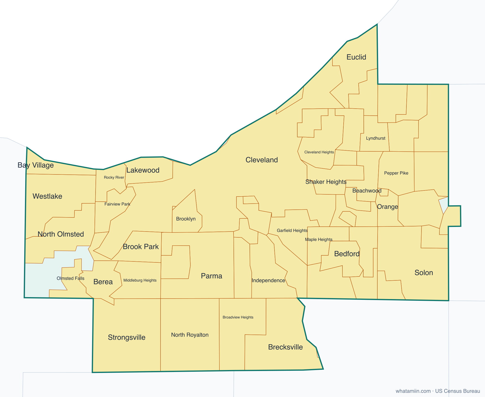
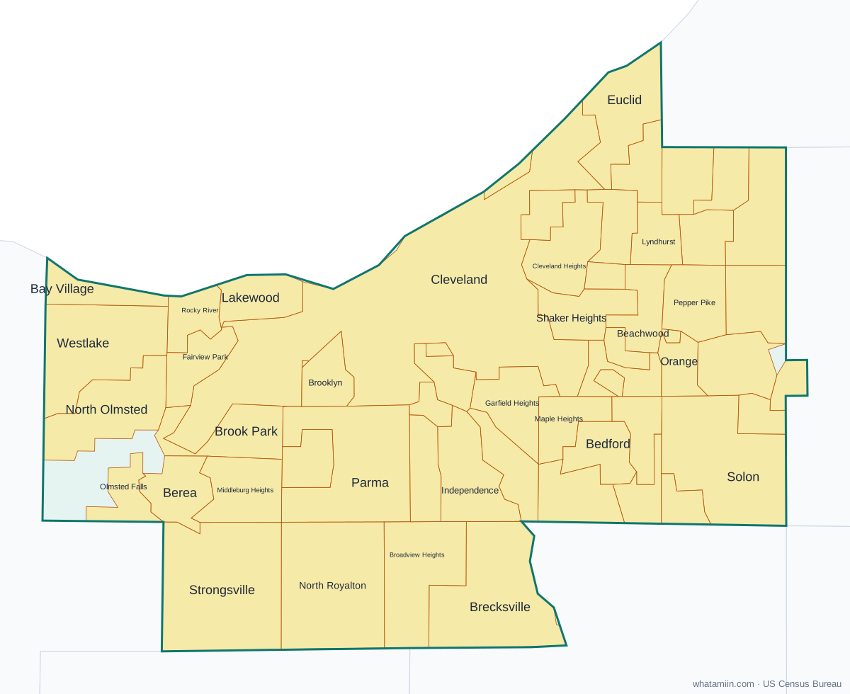
57 incorporated cities, towns and villages have land in Cuyahoga County, led by Cleveland with 365,379 residents inside the county. The rest of the county's people live in unincorporated areas, which the county governs directly.
| City or town | Population in county (2024) |
|---|---|
| Cleveland | 365,379 |
| Parma | 79,350 |
| Lakewood | 49,517 |
| Euclid | 48,421 |
| Strongsville | 45,768 |
| Cleveland Heights | 44,064 |
| Westlake | 34,232 |
| North Olmsted | 31,690 |
| North Royalton | 30,894 |
| Garfield Heights | 29,014 |
| Shaker Heights | 28,689 |
| Solon | 23,875 |
| Maple Heights | 23,081 |
| Rocky River | 21,468 |
| South Euclid | 21,363 |
| Parma Heights | 20,524 |
| Mayfield Heights | 19,886 |
| Broadview Heights | 19,792 |
| Brook Park | 18,142 |
| Berea | 17,998 |
| Fairview Park | 16,860 |
| Bay Village | 15,903 |
| Middleburg Heights | 15,672 |
| Brecksville | 13,951 |
| Beachwood | 13,820 |
| Lyndhurst | 13,700 |
| Warrensville Heights | 13,450 |
| East Cleveland | 13,402 |
| University Heights | 13,265 |
| Bedford | 12,834 |
| Seven Hills | 11,560 |
| Brooklyn | 11,072 |
| Bedford Heights | 10,791 |
| Richmond Heights | 10,552 |
| Olmsted Falls | 8,676 |
| Highland Heights | 8,612 |
| Independence | 7,518 |
| Pepper Pike | 6,881 |
| Chagrin Falls | 4,118 |
| Orange | 3,544 |
| Oakwood | 3,496 |
| Moreland Hills | 3,489 |
| Mayfield | 3,324 |
| Gates Mills | 2,250 |
| Walton Hills | 1,997 |
| Valley View | 1,858 |
| Newburgh Heights | 1,815 |
| Brooklyn Heights | 1,480 |
| Bratenahl | 1,404 |
| Glenwillow | 988 |
| North Randall | 934 |
| Bentleyville | 887 |
| Highland Hills | 697 |
| Hunting Valley | 648 |
| Woodmere | 639 |
| Cuyahoga Heights | 556 |
| Linndale | 109 |
Townships and county subdivisions
Bay Village city, Beachwood city, Bedford Heights city, Bedford city, Bentleyville village, Berea city, Bratenahl village, Brecksville city, Broadview Heights city, Brook Park city, Brooklyn Heights village, Brooklyn city, Chagrin Falls township, Cleveland Heights city, Cleveland city, Cuyahoga Heights village, East Cleveland city, Euclid city, Fairview Park city, Garfield Heights city, Gates Mills village, Glenwillow village, Highland Heights city, Highland Hills village, Hunting Valley village, Independence city, Lakewood city, Linndale village, Lyndhurst city, Maple Heights city, Mayfield Heights city, Mayfield village, Middleburg Heights city, Moreland Hills village, Newburgh Heights village, North Olmsted city, North Randall village, North Royalton city, Oakwood village, Olmsted Falls city, Olmsted township, Orange village, Parma Heights city, Parma city, Pepper Pike city, Richmond Heights city, Rocky River city, Seven Hills city, Shaker Heights city, Solon city, South Euclid city, Strongsville city, University Heights city, Valley View village, Walton Hills village, Warrensville Heights city, Westlake city, Woodmere village
ZIP codes in Cuyahoga County
52 ZIP code areas include land in Cuyahoga County.
Mostly in Cuyahoga County: 44017, 44022, 44040, 44070, 44101, 44102, 44103, 44104, 44105, 44106, 44107, 44108, 44109, 44110, 44111, 44112, 44113, 44114, 44115, 44116, 44117, 44118, 44119, 44120, 44121, 44122, 44123, 44124, 44125, 44126, 44127, 44128, 44129, 44130, 44131, 44132, 44133, 44134, 44135, 44136, 44137, 44138, 44139, 44140, 44141, 44142, 44143, 44144, 44145, 44146, 44147, 44149
Neighboring counties
Geauga County · Lake County · Lorain County · Medina County · Portage County · Summit County
See every county on the Ohio county map or in the list of Ohio counties, or find ZIP areas on the Ohio ZIP code map. To check which county an exact address is in, use what county am I in.
More Ohio county profiles: Franklin County · Hamilton County