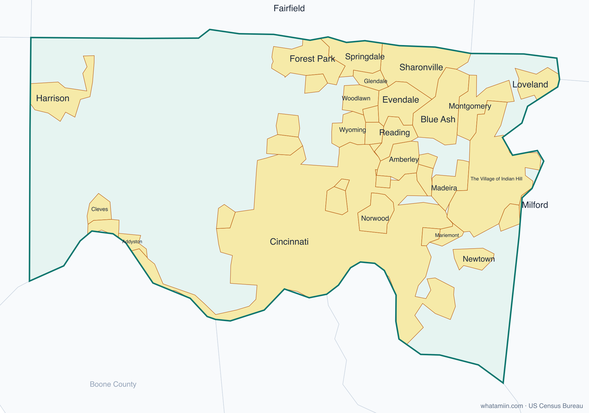
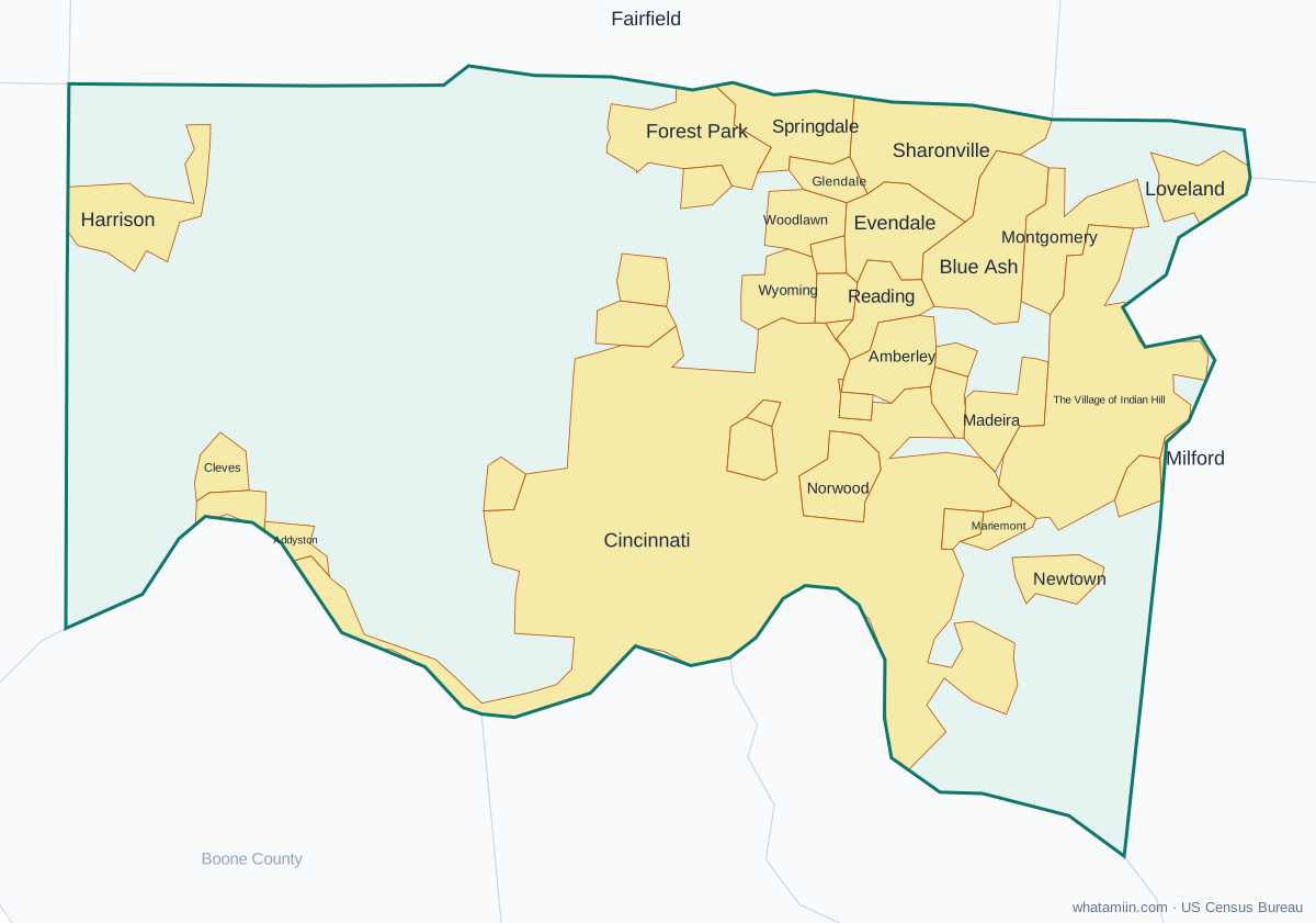
Hamilton County at a glance
| County seat | Cincinnati |
|---|---|
| Population (2024) | 837,359 · 3rd of 88 in Ohio |
| Change since 2020 | +0.8% |
| Land area | 406 sq mi |
| Density | 2,065 people per sq mi |
| Time zone | Eastern |
| Elevation | 466 ft to 925 ft (median 745 ft) |
| FIPS code | 39061 |
Cities and towns in Hamilton County
38 incorporated cities, towns and villages have land in Hamilton County, led by Cincinnati with 314,915 residents inside the county. The rest of the county's people live in unincorporated areas, which the county governs directly.
| City or town | Population in county (2024) |
|---|---|
| Cincinnati | 314,915 |
| Forest Park | 20,033 |
| Norwood | 19,455 |
| Blue Ash | 13,616 |
| Harrison | 13,526 |
| Sharonville | 11,464 |
| Springdale | 11,183 |
| Montgomery | 10,952 |
| Reading | 10,482 |
| Loveland | 9,705 |
| North College Hill | 9,552 |
| Madeira | 9,542 |
| Wyoming | 8,781 |
| Cheviot | 8,640 |
| Mount Healthy | 6,916 |
| The Village of Indian Hill | 6,090 |
| Deer Park | 5,437 |
| Silverton | 4,858 |
| St. Bernard | 3,976 |
| Woodlawn | 3,913 |
| Amberley | 3,847 |
| Golf Manor | 3,797 |
| Greenhills | 3,699 |
| Lockland | 3,503 |
| Mariemont | 3,487 |
| Cleves | 3,387 |
| Lincoln Heights | 3,139 |
| Newtown | 2,687 |
| Evendale | 2,658 |
| Terrace Park | 2,350 |
| Glendale | 2,282 |
| Elmwood Place | 2,077 |
| Fairfax | 1,761 |
| Addyston | 914 |
| North Bend | 834 |
| Arlington Heights | 820 |
| Milford | 25 |
| Fairfield | 0 |
Townships and county subdivisions
Amberley village, Anderson township, Arlington Heights village, Blue Ash city, Cheviot city, Cincinnati city, Colerain township, Columbia township, Crosby township, Deer Park city, Delhi township, Elmwood Place village, Evendale village, Fairfax village, Fairfield city, Forest Park city, Glendale village, Golf Manor village, Green township, Greenhills village, Harrison township, Lincoln Heights village, Lockland village, Loveland city, Madeira city, Mariemont village, Miami township, Milford city, Montgomery city, Mount Healthy city, Newtown village, North College Hill city, Norwood city, Reading city, Sharonville city, Silverton village, Springdale city, Springfield township, St. Bernard village, Sycamore township, Symmes township, Terrace Park village, The Village of Indian Hill city, Whitewater township, Woodlawn village, Wyoming city
ZIP codes in Hamilton County
58 ZIP code areas include land in Hamilton County. 4 of them lie mostly in a neighboring county.
Mostly in Hamilton County: 45001, 45002, 45030, 45033, 45041, 45051, 45052, 45111, 45174, 45202, 45203, 45204, 45205, 45206, 45207, 45208, 45209, 45211, 45212, 45213, 45214, 45215, 45216, 45217, 45218, 45219, 45220, 45223, 45224, 45225, 45226, 45227, 45229, 45230, 45231, 45232, 45233, 45236, 45237, 45238, 45239, 45240, 45241, 45242, 45243, 45244, 45246, 45247, 45248, 45249, 45251, 45252, 45255, 45267
Partly in Hamilton County: 45013, 45069, 45140, 45150
Neighboring counties
Dearborn County, IN · Franklin County, IN · Boone County, KY · Campbell County, KY · Kenton County, KY · Butler County · Clermont County · Warren County
See every county on the Ohio county map or in the list of Ohio counties, or find ZIP areas on the Ohio ZIP code map. To check which county an exact address is in, use what county am I in.
More Ohio county profiles: Cuyahoga County · Franklin County