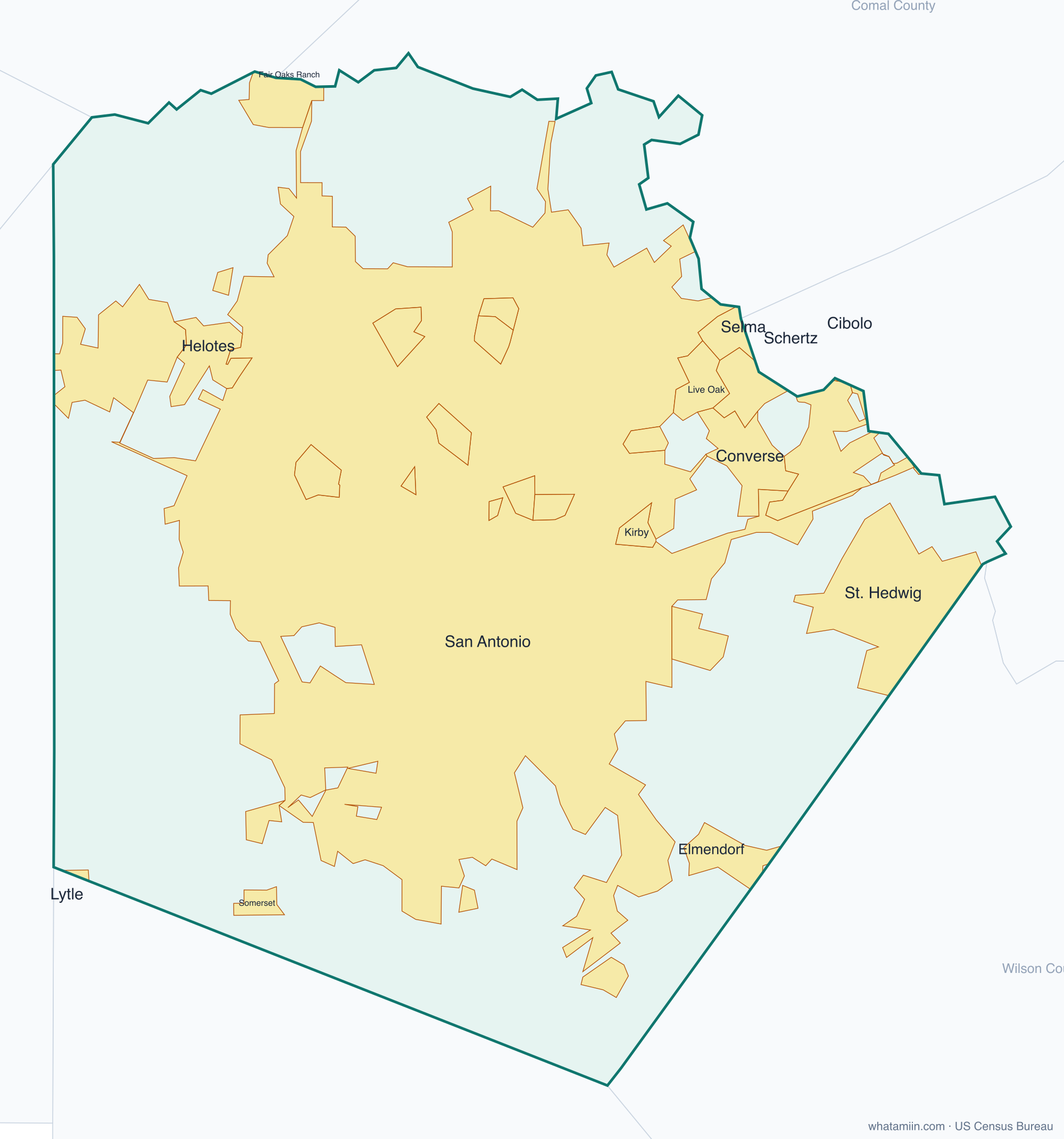
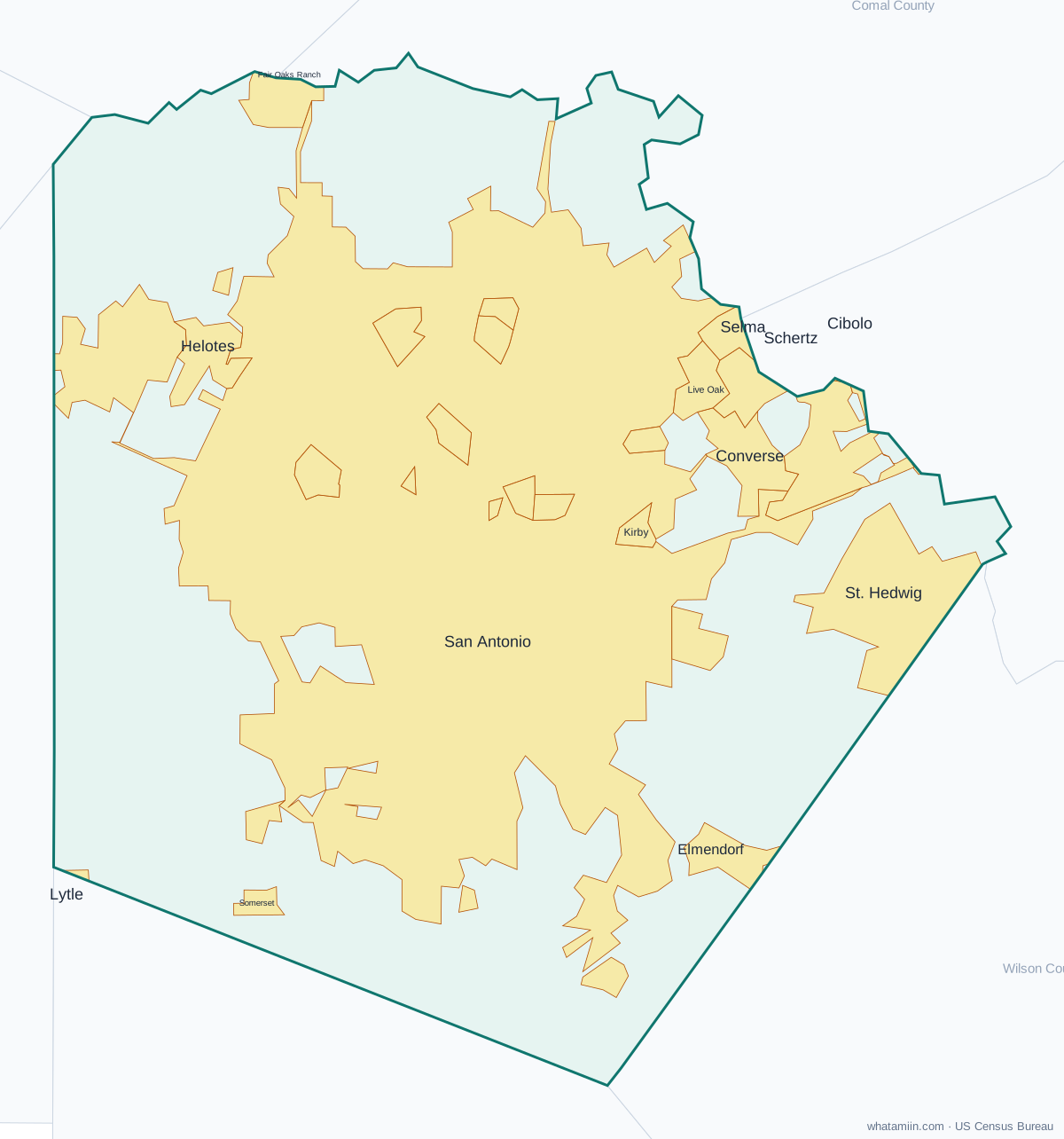
Bexar County at a glance
| County seat | San Antonio |
|---|---|
| Population (2024) | 2,127,737 · 4th of 254 in Texas |
| Change since 2020 | +5.9% |
| Land area | 1,240 sq mi |
| Density | 1,715 people per sq mi |
| Time zone | Central |
| Elevation | 449 ft to 1,821 ft (median 722 ft) |
| FIPS code | 48029 |
Cities and towns in Bexar County
28 incorporated cities, towns and villages have land in Bexar County, led by San Antonio with 1,526,645 residents inside the county. The rest of the county's people live in unincorporated areas, which the county governs directly.
| City or town | Population in county (2024) |
|---|---|
| San Antonio | 1,526,645 |
| Converse | 31,400 |
| Universal City | 20,267 |
| Live Oak | 16,218 |
| Leon Valley | 11,424 |
| Helotes | 10,223 |
| Kirby | 8,104 |
| Selma | 7,803 |
| Alamo Heights | 7,557 |
| Fair Oaks Ranch | 7,453 |
| Schertz | 6,169 |
| Windcrest | 5,782 |
| Sandy Oaks | 5,698 |
| Terrell Hills | 5,142 |
| Castle Hills | 3,931 |
| Shavano Park | 3,807 |
| Hollywood Park | 3,128 |
| Balcones Heights | 2,707 |
| Elmendorf | 2,676 |
| St. Hedwig | 2,377 |
| Olmos Park | 2,155 |
| Somerset | 1,843 |
| Von Ormy | 1,215 |
| China Grove | 1,138 |
| Hill Country Village | 949 |
| Grey Forest | 517 |
| Lytle | 31 |
| Cibolo | 0 |
Townships and county subdivisions
San Antonio Central CCD, San Antonio East CCD, San Antonio North CCD, San Antonio Northeast CCD, San Antonio Northwest CCD, San Antonio South CCD, San Antonio West CCD
ZIP codes in Bexar County
78 ZIP code areas include land in Bexar County. 8 of them lie mostly in a neighboring county.
Mostly in Bexar County: 78002, 78023, 78073, 78101, 78109, 78112, 78148, 78150, 78152, 78154, 78201, 78202, 78203, 78204, 78205, 78207, 78208, 78209, 78210, 78211, 78212, 78213, 78214, 78215, 78216, 78217, 78218, 78219, 78220, 78221, 78222, 78223, 78224, 78225, 78226, 78227, 78228, 78229, 78230, 78231, 78232, 78233, 78234, 78235, 78236, 78237, 78238, 78239, 78240, 78242, 78243, 78244, 78245, 78247, 78248, 78249, 78250, 78251, 78252, 78253, 78254, 78255, 78256, 78257, 78258, 78259, 78260, 78261, 78263, 78264
Partly in Bexar County: 78006, 78015, 78039, 78052, 78069, 78108, 78124, 78266
Neighboring counties
Atascosa County · Bandera County · Comal County · Guadalupe County · Kendall County · Medina County · Wilson County
See every county on the Texas county map or in the list of Texas counties, or find ZIP areas on the Texas ZIP code map. To check which county an exact address is in, use what county am I in.
More Texas county profiles: Collin County · Dallas County · Denton County · El Paso County · Fort Bend County · Harris County · Hidalgo County · Montgomery County · Tarrant County · Travis County · Williamson County