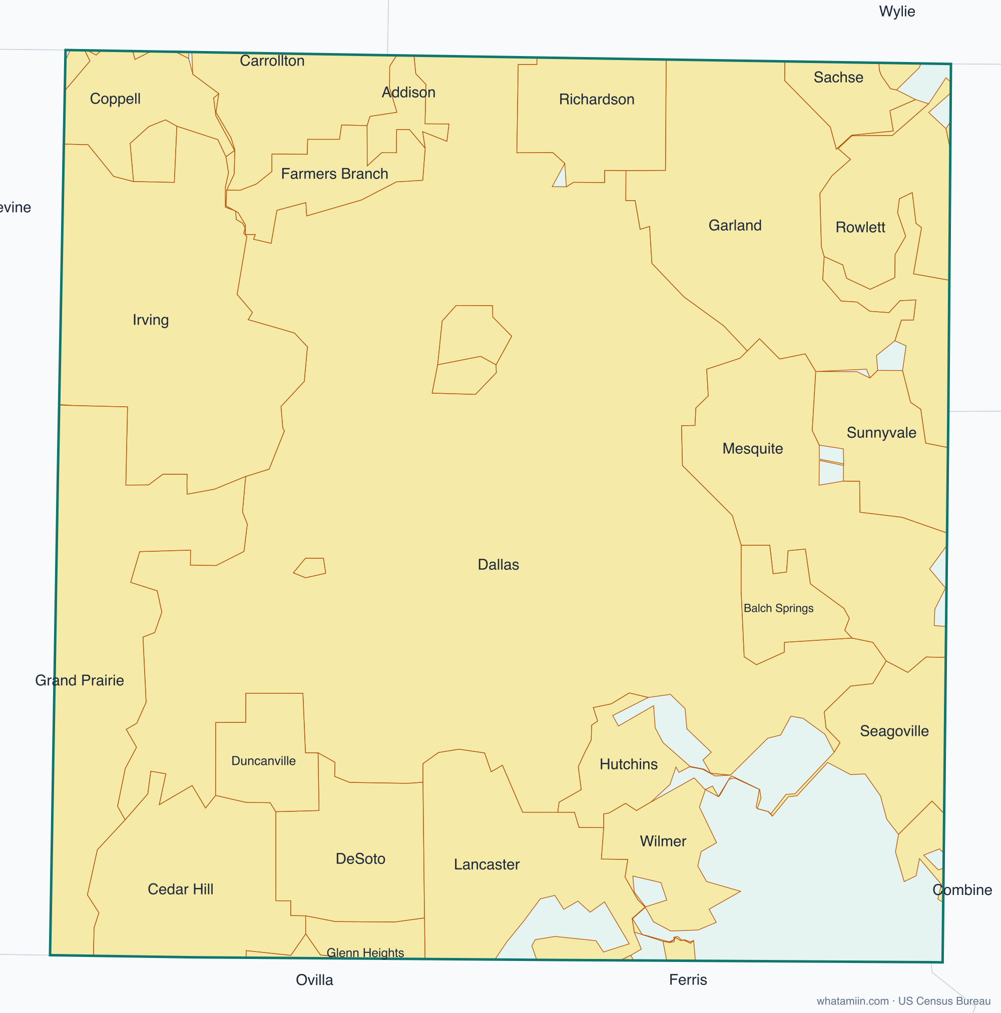
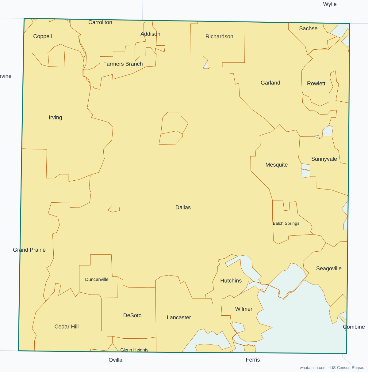
Dallas County at a glance
| County seat | Dallas |
|---|---|
| Population (2024) | 2,656,028 · 2nd of 254 in Texas |
| Change since 2020 | +1.7% |
| Land area | 873 sq mi |
| Density | 3,042 people per sq mi |
| Time zone | Central |
| Elevation | 361 ft to 850 ft (median 518 ft) |
| FIPS code | 48113 |
Cities and towns in Dallas County
31 incorporated cities, towns and villages have land in Dallas County, led by Dallas with 1,242,071 residents inside the county. The rest of the county's people live in unincorporated areas, which the county governs directly.
| City or town | Population in county (2024) |
|---|---|
| Dallas | 1,242,071 |
| Irving | 258,060 |
| Garland | 250,266 |
| Mesquite | 149,933 |
| Grand Prairie | 131,610 |
| Richardson | 75,575 |
| Rowlett | 59,677 |
| DeSoto | 56,711 |
| Carrollton | 51,247 |
| Cedar Hill | 48,956 |
| Lancaster | 40,780 |
| Coppell | 40,763 |
| Duncanville | 39,203 |
| Farmers Branch | 37,341 |
| Balch Springs | 27,307 |
| University Park | 25,268 |
| Sachse | 20,745 |
| Seagoville | 20,091 |
| Addison | 17,257 |
| Glenn Heights | 13,861 |
| Sunnyvale | 8,839 |
| Highland Park | 8,762 |
| Hutchins | 7,996 |
| Wilmer | 6,774 |
| Cockrell Hill | 3,662 |
| Wylie | 1,608 |
| Lewisville | 1,421 |
| Combine | 927 |
| Ovilla | 313 |
| Ferris | 4 |
| Grapevine | 0 |
Townships and county subdivisions
Northeast Dallas CCD, Southwest Dallas CCD
ZIP codes in Dallas County
95 ZIP code areas include land in Dallas County. 11 of them lie mostly in a neighboring county.
Mostly in Dallas County: 75001, 75006, 75019, 75038, 75039, 75040, 75041, 75042, 75043, 75044, 75048, 75050, 75051, 75052, 75060, 75061, 75062, 75063, 75080, 75081, 75088, 75089, 75104, 75115, 75116, 75134, 75137, 75141, 75146, 75149, 75150, 75159, 75172, 75180, 75181, 75182, 75201, 75202, 75203, 75204, 75205, 75206, 75207, 75208, 75209, 75210, 75211, 75212, 75214, 75215, 75216, 75217, 75218, 75219, 75220, 75223, 75224, 75225, 75226, 75227, 75228, 75229, 75230, 75231, 75232, 75233, 75234, 75235, 75236, 75237, 75238, 75240, 75241, 75243, 75244, 75246, 75247, 75248, 75249, 75251, 75253, 75254, 75270, 75390
Partly in Dallas County: 75007, 75054, 75067, 75082, 75098, 75125, 75154, 75252, 75287, 76051, 76065
Neighboring counties
Collin County · Denton County · Ellis County · Kaufman County · Rockwall County · Tarrant County
See every county on the Texas county map or in the list of Texas counties, or find ZIP areas on the Texas ZIP code map. To check which county an exact address is in, use what county am I in.
More Texas county profiles: Bexar County · Collin County · Denton County · El Paso County · Fort Bend County · Harris County · Hidalgo County · Montgomery County · Tarrant County · Travis County · Williamson County