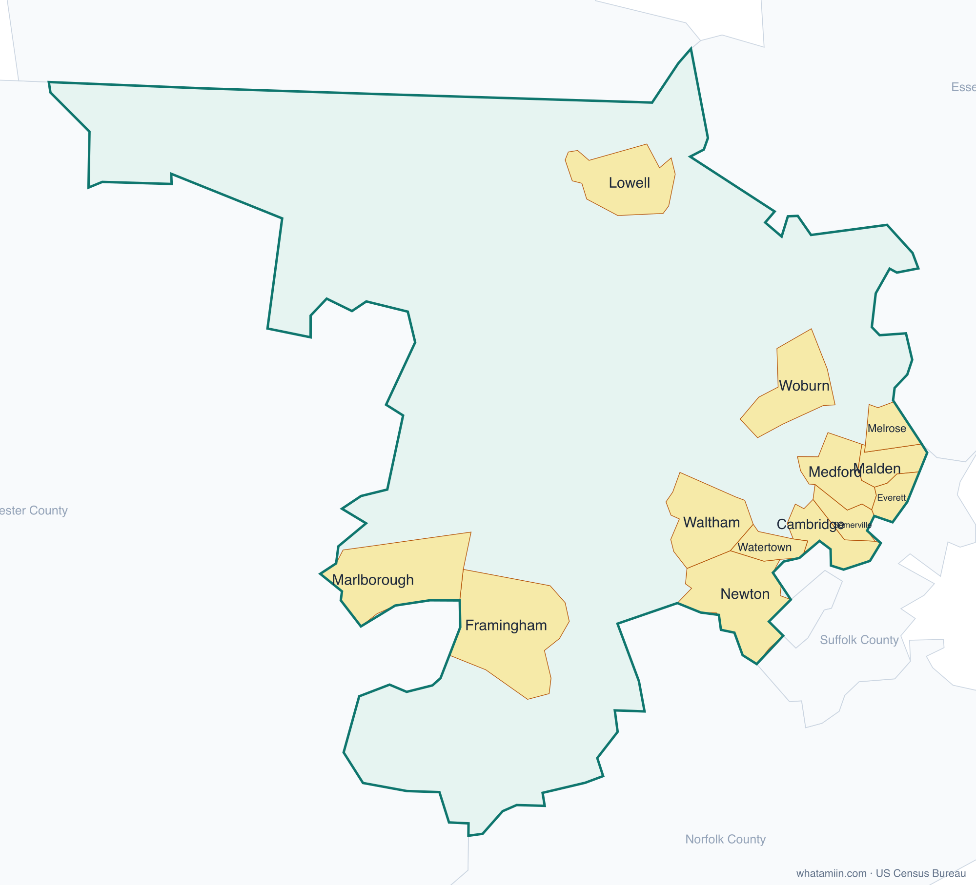
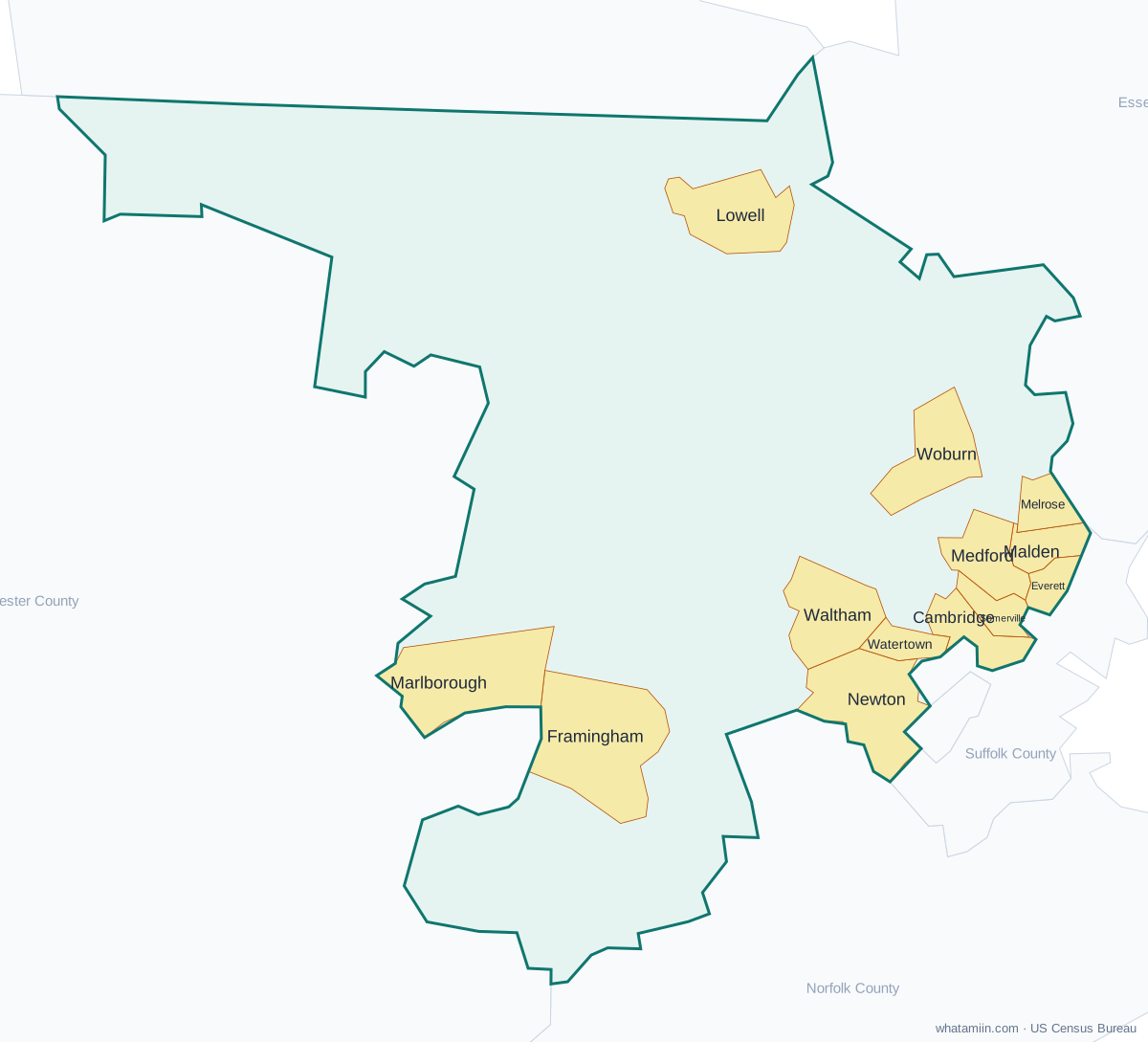
Middlesex County at a glance
| County seat | Cambridge and Lowell |
|---|---|
| Population (2024) | 1,668,956 · 1st of 14 in Massachusetts |
| Change since 2020 | +2.3% |
| Land area | 818 sq mi |
| Density | 2,041 people per sq mi |
| Time zone | Eastern |
| Elevation | 13 ft to 1,102 ft (median 213 ft) |
| FIPS code | 25017 |
Cities and towns in Middlesex County
13 incorporated cities, towns and villages have land in Middlesex County, led by Cambridge with 121,186 residents inside the county. The rest of the county's people live in unincorporated areas, which the county governs directly.
| City or town | Population in county (2024) |
|---|---|
| Cambridge | 121,186 |
| Lowell | 120,418 |
| Newton | 90,700 |
| Somerville | 82,149 |
| Framingham | 73,361 |
| Malden | 66,693 |
| Waltham | 65,849 |
| Medford | 59,898 |
| Everett | 51,825 |
| Woburn | 43,895 |
| Marlborough | 42,169 |
| Watertown | 35,985 |
| Melrose | 29,938 |
Townships and county subdivisions
Acton town, Arlington town, Ashby town, Ashland town, Ayer town, Bedford town, Belmont town, Billerica town, Boxborough town, Burlington town, Cambridge city, Carlisle town, Chelmsford town, Concord town, Dracut town, Dunstable town, Everett city, Framingham city, Groton town, Holliston town, Hopkinton town, Hudson town, Lexington town, Lincoln town, Littleton town, Lowell city, Malden city, Marlborough city, Maynard town, Medford city, Melrose city, Natick town, Newton city, North Reading town, Pepperell town, Reading town, Sherborn town, Shirley town, Somerville city, Stoneham town, Stow town, Sudbury town, Tewksbury town, Townsend town, Tyngsborough town, Wakefield town, Waltham city, Watertown city, Wayland town, Westford town, Weston town, Wilmington town, Winchester town, Woburn city
ZIP codes in Middlesex County
83 ZIP code areas include land in Middlesex County. 2 of them lie mostly in a neighboring county.
Mostly in Middlesex County: 01431, 01432, 01450, 01460, 01463, 01464, 01469, 01474, 01701, 01702, 01718, 01719, 01720, 01721, 01730, 01731, 01741, 01742, 01746, 01748, 01749, 01752, 01754, 01760, 01770, 01773, 01775, 01776, 01778, 01801, 01803, 01821, 01824, 01826, 01827, 01850, 01851, 01852, 01854, 01862, 01863, 01864, 01867, 01876, 01879, 01880, 01886, 01887, 01890, 02138, 02139, 02140, 02141, 02142, 02143, 02144, 02145, 02148, 02149, 02155, 02176, 02180, 02420, 02421, 02451, 02452, 02453, 02458, 02459, 02460, 02461, 02462, 02464, 02465, 02466, 02468, 02472, 02474, 02476, 02478, 02493
Partly in Middlesex County: 01434, 02467
Neighboring counties
Essex County · Norfolk County · Suffolk County · Worcester County · Hillsborough County, NH
See every county on the Massachusetts county map or in the list of Massachusetts counties, or find ZIP areas on the Massachusetts ZIP code map. To check which county an exact address is in, use what county am I in.
More Massachusetts county profiles: Essex County · Norfolk County · Suffolk County · Worcester County