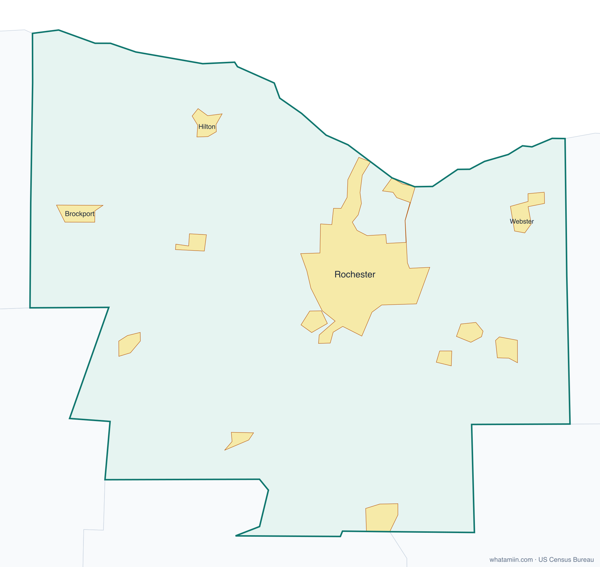
Monroe County at a glance
| County seat | Rochester |
|---|---|
| Population (2024) | 752,202 · 9th of 62 in New York |
| Change since 2020 | -0.9% |
| Land area | 657 sq mi |
| Density | 1,145 people per sq mi |
| Time zone | Eastern |
| Elevation | 240 ft to 768 ft (median 528 ft) |
| FIPS code | 36055 |
Cities and towns in Monroe County
11 incorporated cities, towns and villages have land in Monroe County, led by Rochester with 207,282 residents inside the county. The rest of the county's people live in unincorporated areas, which the county governs directly.
| City or town | Population in county (2024) |
|---|---|
| Rochester | 207,282 |
| Brockport | 7,489 |
| East Rochester | 6,139 |
| Hilton | 5,975 |
| Webster | 5,787 |
| Fairport | 5,341 |
| Spencerport | 3,616 |
| Honeoye Falls | 2,817 |
| Churchville | 2,184 |
| Scottsville | 2,004 |
| Pittsford | 1,327 |
Townships and county subdivisions
Brighton town, Chili town, Clarkson town, East Rochester town, Gates town, Greece town, Hamlin town, Henrietta town, Irondequoit town, Mendon town, Ogden town, Parma town, Penfield town, Perinton town, Pittsford town, Riga town, Rochester city, Rush town, Sweden town, Webster town, Wheatland town
ZIP codes in Monroe County
52 ZIP code areas include land in Monroe County. 8 of them lie mostly in a neighboring county.
Mostly in Monroe County: 14420, 14428, 14445, 14450, 14464, 14467, 14468, 14472, 14506, 14511, 14514, 14515, 14526, 14534, 14543, 14546, 14559, 14580, 14586, 14604, 14605, 14606, 14607, 14608, 14609, 14610, 14611, 14612, 14613, 14614, 14615, 14616, 14617, 14618, 14619, 14620, 14621, 14622, 14623, 14624, 14625, 14626, 14627, 14642
Partly in Monroe County: 14414, 14416, 14470, 14476, 14482, 14502, 14519, 14564
Neighboring counties
Genesee County · Livingston County · Ontario County · Orleans County · Wayne County
See every county on the New York county map or in the list of New York counties, or find ZIP areas on the New York ZIP code map. To check which county an exact address is in, use what county am I in.
More New York county profiles: Bronx County · Erie County · Kings County · Nassau County · New York County · Queens County · Suffolk County · Westchester County